IMAGES TAKEN NEAR TO
Juniper Close, LIVERPOOL, L28 5RX
Introduction
This page details the photographs taken nearby to Juniper Close, L28 5RX by members of the Geograph project.
The Geograph project started in 2005 with the aim of publishing, organising and preserving representative images for every square kilometre of Great Britain, Ireland and the Isle of Man.

There are currently over 7.5m images from over14,400 individuals and you can help contribute to the project by visiting https://www.geograph.org.uk
Image Map (5 Images)
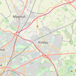
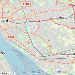
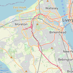

Leaflet Map data © OpenStreetMap
Images are licensed for reuse under creativecommons.org/licenses/by-sa/2.0
Notes
- Clicking on the map will re-center to the selected point.
- The higher the marker number, the further away the image location is from the centre of the postcode.
Image Listing (5 Images Found)
Images are licensed for reuse under creativecommons.org/licenses/by-sa/2.0
Image
Details
Distance
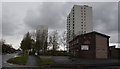
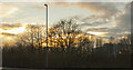
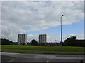
2
Haswell Drive, Stockbridge Village
Haswell Drive, Stockbridge Village with the Tithebarn public house dwarfed by the tower blocks Merecliff in the foreground, Denecliff to the left and Tarncliff at the rear.
Image: © Sue Adair
Taken: 27 Jul 2007
0.05 miles
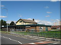
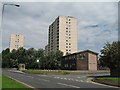
3
Stockbridge Village
Tower blocks in Stockbridge Village as seen from the leisure centre in square SJ4293, the one on the right just falls into this square.
Image: © Sue Adair
Taken: 14 Aug 2005
0.08 miles