IMAGES TAKEN NEAR TO
Blacklock Hall Road, LIVERPOOL, L24 3TY

Introduction

This page details the photographs taken nearby to Blacklock Hall Road, L24 3TY by members of the Geograph project.

The Geograph project started in 2005 with the aim of publishing, organising and preserving representative images for every square kilometre of Great Britain, Ireland and the Isle of Man.

There are currently over 7.5m images from over14,400 individuals and you can help contribute to the project by visiting https://www.geograph.org.uk

Image Map


Images are licensed for reuse under creativecommons.org/licenses/by-sa/2.0
Notes
  • Clicking on the map will re-center to the selected point.
  • The higher the marker number, the further away the image location is from the centre of the postcode.

Image Listing (25 Images Found)

Images are licensed for reuse under creativecommons.org/licenses/by-sa/2.0
  • ...
Image
Details
Distance
1
Terraced housing in All Saints Road, Speke
Image: © Eirian Evans Taken: 6 Jul 2011
0.09 miles
2
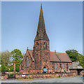
All Saints' Church, Speke
The Church of All Saints, at Speke, was built in 1876. http://www.spekeliverpool.co.uk/ Parish website
Image: © David Dixon Taken: 5 Jun 2016
0.12 miles
3
The Church of All Saints, Speke
The Church of All Saints, at Speke, was built in 1876. http://www.spekeliverpool.co.uk/ Parish website
Image: © David Dixon Taken: 5 Jun 2016
0.12 miles
4
All Saints Church, Speke
Image: © Eirian Evans Taken: 6 Jul 2011
0.12 miles
5
All Saints' Church, Speke
The Church of All Saint’s, at Speke, was built in 1876. http://www.spekeliverpool.co.uk/ Parish website
Image: © David Dixon Taken: 24 May 2012
0.12 miles
6
All Saints Church, Speke
Image: © Ian Greig Taken: 23 Mar 2012
0.12 miles
7
All Saints' Church, Speke
Image: © N Chadwick Taken: 21 Mar 2016
0.13 miles
8
All Saints Church, Speke
All Saints Church was built in 1876 in the ancient village of Speke which was mentioned in the Domesday Book, long before the vast housing estate that most people associate with the name. Consisting of a few farms, not far from the riverbank, at the widest part of the Mersey where the land was good agricultural farmland. The stone from which All Saints was built from was taken from the old Quarry in Delph Lane.
Image: © Sue Adair Taken: 13 Feb 2008
0.14 miles
9
Speke War Memorial (Names)
The War Memorial is at the corner of the churchyard of Image] which can be seen behind the monument. There are nine names listed on the front of the cross; reflecting that Speke was only a small village at the time of the First World War. For more information about these men, see http://www.spekeliverpool.co.uk/page22.html .
Image: © David Dixon Taken: 5 Jun 2016
0.14 miles
10
Speke, War Memorial at All Saints' Church
The War Memorial is at the corner of the churchyard of Image which can be seen behind the monument. There are nine names listed on the front of the cross (Image) reflecting that Speke was only a small village at the time of the First World War. For more information about these men, see http://www.spekeliverpool.co.uk/page22.html .
Image: © David Dixon Taken: 5 Jun 2016
0.14 miles
  • ...