IMAGES TAKEN NEAR TO
Stewards Road, LIVERPOOL, L24 1WR
Introduction
This page details the photographs taken nearby to Stewards Road, L24 1WR by members of the Geograph project.
The Geograph project started in 2005 with the aim of publishing, organising and preserving representative images for every square kilometre of Great Britain, Ireland and the Isle of Man.

There are currently over 7.5m images from over14,400 individuals and you can help contribute to the project by visiting https://www.geograph.org.uk
Image Map
Images are licensed for reuse under creativecommons.org/licenses/by-sa/2.0
Notes
- Clicking on the map will re-center to the selected point.
- The higher the marker number, the further away the image location is from the centre of the postcode.
Image Listing (51 Images Found)
Images are licensed for reuse under creativecommons.org/licenses/by-sa/2.0
Image
Details
Distance
2
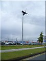
Wind Turbine near John Lennon Airport
Image: © Anthony Parkes
Taken: 8 Jul 2011
0.11 miles
3
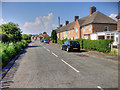
Tewit Hall Road/All Saints Road junction.
Image: © Colin Pyle
Taken: 22 Feb 2010
0.11 miles

7

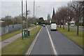
Premier Inn, Speke Hall Avenue, Liverpool
Handy for the airport and for those staying at the Holiday Inn Express to have a half-decent meal.
Image: © Jonathan Billinger
Taken: 2 Sep 2013
0.13 miles
8
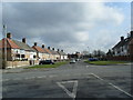
Speke Hall Avenue towards John Lennon Airport
Image: © JThomas
Taken: 24 Mar 2012
0.13 miles
10
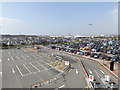
Car park at Liverpool John Lennon airport
Viewed from the multi storey car park at the Hampton Hotel.
Image: © Richard Hoare
Taken: 9 Apr 2015
0.17 miles