IMAGES TAKEN NEAR TO
Hale Road, LIVERPOOL, L24 1UG
Introduction
This page details the photographs taken nearby to Hale Road, L24 1UG by members of the Geograph project.
The Geograph project started in 2005 with the aim of publishing, organising and preserving representative images for every square kilometre of Great Britain, Ireland and the Isle of Man.

There are currently over 7.5m images from over14,400 individuals and you can help contribute to the project by visiting https://www.geograph.org.uk
Image Map
Images are licensed for reuse under creativecommons.org/licenses/by-sa/2.0
Notes
- Clicking on the map will re-center to the selected point.
- The higher the marker number, the further away the image location is from the centre of the postcode.
Image Listing (26 Images Found)
Images are licensed for reuse under creativecommons.org/licenses/by-sa/2.0
Image
Details
Distance
1
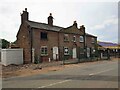
Speke: Grade II Listed Cottages - Nos 30, 32 & 34 Hale Road
According to the Historic England website these cottages date from the late 18th century and so predate the nearby Church of All Saints by some margin. They are currently being refurbished by their owners, South Liverpool Homes, as part of a new development of 15 bungalows in their vicinity.
Quite why they were numbered 30, 32 & 34 is a mystery to the photographer. All editions of the large scale Ordnance Survey mapping show them in splendid isolation with no other residential buildings on that side of the road at all, and to complicate matters further in the 1954 edition they are clearly numbered 31, 32 and 33, with the 31 and 33 duplicating the numbers of the new post-war housing on the other side of the road.
A clue might be found in the 1881 Census where all the cottages in the village of Speke were given numbers, so maybe these were originally Numbers 31 to 33 in that scheme.
Image: © Nigel Cox
Taken: 24 Jul 2021
0.01 miles
3
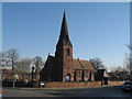
All Saints Church, Speke
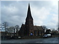
All Saints Church was built in 1876 in the ancient village of Speke which was mentioned in the Domesday Book, long before the vast housing estate that most people associate with the name. Consisting of a few farms, not far from the riverbank, at the widest part of the Mersey where the land was good agricultural farmland. The stone from which All Saints was built from was taken from the old Quarry in Delph Lane.
Image: © Sue Adair
Taken: 13 Feb 2008
0.03 miles
4
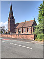
All Saints' Church, Speke
The Church of All Saints, at Speke, was built in 1876.
http://www.spekeliverpool.co.uk/ Parish website
Image: © David Dixon
Taken: 5 Jun 2016
0.03 miles
5
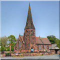
All Saints' Church, Speke
The Church of All Saint’s, at Speke, was built in 1876.
http://www.spekeliverpool.co.uk/ Parish website
Image: © David Dixon
Taken: 24 May 2012
0.03 miles
8
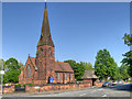
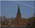
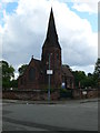
The Church of All Saints, Speke
The Church of All Saints, at Speke, was built in 1876.
http://www.spekeliverpool.co.uk/ Parish website
Image: © David Dixon
Taken: 5 Jun 2016
0.03 miles
9
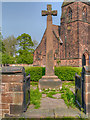
All Saints' War Memorial, Speke
The War Memorial is at the corner of the churchyard of Image] which can be seen behind the monument.
Image: © David Dixon
Taken: 24 May 2012
0.03 miles