IMAGES TAKEN NEAR TO
Sevenacre Road, LIVERPOOL, L23 9UH
Introduction
This page details the photographs taken nearby to Sevenacre Road, L23 9UH by members of the Geograph project.
The Geograph project started in 2005 with the aim of publishing, organising and preserving representative images for every square kilometre of Great Britain, Ireland and the Isle of Man.

There are currently over 7.5m images from over14,400 individuals and you can help contribute to the project by visiting https://www.geograph.org.uk
Image Map
Images are licensed for reuse under creativecommons.org/licenses/by-sa/2.0
Notes
- Clicking on the map will re-center to the selected point.
- The higher the marker number, the further away the image location is from the centre of the postcode.
Image Listing (8 Images Found)
Images are licensed for reuse under creativecommons.org/licenses/by-sa/2.0
Image
Details
Distance
3
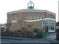
St William of York
Locally known as the Thrupenny-bit church
Image: © Peter Hodge
Taken: 24 Dec 2005
0.20 miles
4
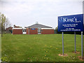
Rushton's Nursery, Garden Centre and Coffee Shop
Image: © David Dixon
Taken: 7 May 2016
0.22 miles
5
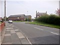
Tanhouse Farm
Tanhouse Farm in Runnel's Lane is more commonly known as Rushton's Garden Centre and Coffee Shop.
Image: © Sue Adair
Taken: 13 Jan 2012
0.23 miles
6
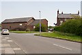
Greenhouses at Rushton Nursery and Garden Centre
Image: © David Dixon
Taken: 7 May 2016
0.23 miles
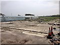
8
Glasshouses at Rushton Garden Centre, Thornton
Image: © Mike Pennington
Taken: 30 Jun 2015
0.24 miles