IMAGES TAKEN NEAR TO
Sunningdale Drive, LIVERPOOL, L23 7XA
Introduction
This page details the photographs taken nearby to Sunningdale Drive, L23 7XA by members of the Geograph project.
The Geograph project started in 2005 with the aim of publishing, organising and preserving representative images for every square kilometre of Great Britain, Ireland and the Isle of Man.

There are currently over 7.5m images from over14,400 individuals and you can help contribute to the project by visiting https://www.geograph.org.uk
Image Map
Images are licensed for reuse under creativecommons.org/licenses/by-sa/2.0
Notes
- Clicking on the map will re-center to the selected point.
- The higher the marker number, the further away the image location is from the centre of the postcode.
Image Listing (17 Images Found)
Images are licensed for reuse under creativecommons.org/licenses/by-sa/2.0
Image
Details
Distance
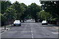
3
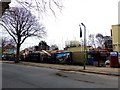
New luxury homes being built in Hall Road East
Image: © Norman Caesar
Taken: 12 Mar 2016
0.11 miles
5
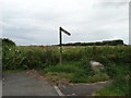
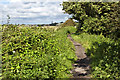
Start of the path to Little Crosby
With Sniggery Wood behind.
Image: © Neil Theasby
Taken: 14 Jul 2014
0.12 miles
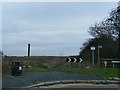
6

Dibb Lane looking towards Little Crosby
Image: © Norman Caesar
Taken: 14 Jan 2012
0.13 miles
8
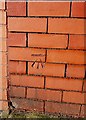
Benchmark
This benchmark is on the boundary wall of The Paddock Hall Road East
Image: © Norman Caesar
Taken: 28 Jan 2012
0.17 miles
9
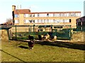
Sheep at school
St. Michael's Church of England High School now have sheep within the school grounds
Image: © Norman Caesar
Taken: 6 Feb 2015
0.18 miles