IMAGES TAKEN NEAR TO
Beech Park, LIVERPOOL, L23 2XT
Introduction
This page details the photographs taken nearby to Beech Park, L23 2XT by members of the Geograph project.
The Geograph project started in 2005 with the aim of publishing, organising and preserving representative images for every square kilometre of Great Britain, Ireland and the Isle of Man.

There are currently over 7.5m images from over14,400 individuals and you can help contribute to the project by visiting https://www.geograph.org.uk
Image Map
Images are licensed for reuse under creativecommons.org/licenses/by-sa/2.0
Notes
- Clicking on the map will re-center to the selected point.
- The higher the marker number, the further away the image location is from the centre of the postcode.
Image Listing (22 Images Found)
Images are licensed for reuse under creativecommons.org/licenses/by-sa/2.0
Image
Details
Distance
1
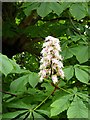
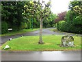
Horse Chestnut flower (aesculus hippocastanum)
Image: © Norman Caesar
Taken: 21 May 2016
0.04 miles
2
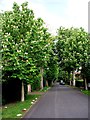
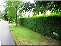
Chestnut trees in flower, Chestnut Avenue
Image: © Norman Caesar
Taken: 21 May 2012
0.07 miles
4
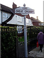
Great Crosby boundary sign, Moor Lane
Image: © Norman Caesar
Taken: 19 Jan 2012
0.09 miles
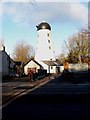
7
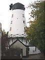
Crosby Windmill
Situated in Moor Lane. Built 1813 and converted into a residence some years ago. Unusually the stumps of the sail stocks are still bolted in place on the windshaft.
Image: © Colin Mitchell
Taken: 24 Oct 2005
0.15 miles
9
Windmill, Moor Lane
The access and base to the windmill has been altered
Image: © Norman Caesar
Taken: 14 Jan 2015
0.15 miles
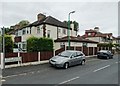
10
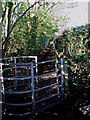
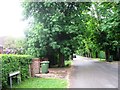
Old Lane
This lane connects Chestnut Avenue with the path around the Crosby Hall Estate
Image: © Norman Caesar
Taken: 6 Nov 2011
0.15 miles