IMAGES TAKEN NEAR TO
Oxford Road, BOOTLE, L20 9HL

Introduction

This page details the photographs taken nearby to Oxford Road, L20 9HL by members of the Geograph project.

The Geograph project started in 2005 with the aim of publishing, organising and preserving representative images for every square kilometre of Great Britain, Ireland and the Isle of Man.

There are currently over 7.5m images from over14,400 individuals and you can help contribute to the project by visiting https://www.geograph.org.uk

Image Map


Images are licensed for reuse under creativecommons.org/licenses/by-sa/2.0
Notes
  • Clicking on the map will re-center to the selected point.
  • The higher the marker number, the further away the image location is from the centre of the postcode.

Image Listing (15 Images Found)

Images are licensed for reuse under creativecommons.org/licenses/by-sa/2.0
Image
Details
Distance
1
Drinking Fountain, Derby Park
This cast-iron drinking fountain with four basins arranged around an ornate, tall column, originally stood in the grounds of Bootle hospital. The fountain bears an inscription stating that it commemorates the marriage of the Duke and Duchess of York in 1893.
Image: © Sue Adair Taken: 9 Aug 2009
0.07 miles
2
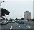
Tower Block - Liverpool
Image: © Anthony Parkes Taken: 23 Sep 2012
0.10 miles
3
Southport Road
Looking north east on the A5038.
Image: © JThomas Taken: 28 Apr 2019
0.10 miles
4
Houses on Southport Road
Image: © JThomas Taken: 28 Apr 2019
0.11 miles
5
The Poulsom Memorial, Derby Park
The Poulsom Memorial commemorates William Poulsom and his wife Mary. William became Lord Mayor of Bootle in 1880 and later a magistrate. Mary was responsible for the Penny Concerts held each Saturday evening during the winter months and for other good deeds amongst the poor of the borough. William died in 1903 and his wife soon after, the memorial was paid for by public subscription and was recently restored by specialist stone mason Nick Roberson who hand carved four replacement figures of children in ancient classical costume working on archive photographs of the originals.
Image: © Sue Adair Taken: 9 Aug 2009
0.11 miles
6
Christ Church
Bootle
Image: © Peter Hodge Taken: 7 Jan 2006
0.15 miles
7
Christ Church, Bootle
Christ Church was built in 1866 by P J Mather of Bootle Hall as a memorial to his daughter. Faced in red sandstone, which probably came from Woolton quarry the same source as Liverpool Cathedral. The eight bronze bells previously hung in Emmanuel Church, Everton, prior to its demolition in 1972. The six steel bells originally hung in the tower are now in St Mary's, Hale near Liverpool airport.
Image: © Sue Adair Taken: 9 Aug 2009
0.15 miles
8
Breeze Hill Traffic Light Junction
Image: © Anthony Parkes Taken: 8 Jul 2017
0.17 miles
9
Christ Church School Park Street
Former Christ Church School on the corner corner of Hawthorne Road and Park Road, built in the second half of the 19th Century. It is now a YMCA used for community groups including drama, youth & junior clubs, Beavers, Cubs, Scouts and Venture Scouts.
Image: © Sue Adair Taken: 3 Jan 2020
0.18 miles
10
Hillside High School
Hillside High School on Breeze Hill opened in 1987. The school was formed in 1972 when Bootle Girls' Grammar School combined with Balliol County Secondary School remaining on two separate sites until 1987 when the new building was completed.
Image: © Sue Adair Taken: 6 Aug 2016
0.18 miles