IMAGES TAKEN NEAR TO
Southport Road, BOOTLE, L20 0BR
Introduction
This page details the photographs taken nearby to Southport Road, L20 0BR by members of the Geograph project.
The Geograph project started in 2005 with the aim of publishing, organising and preserving representative images for every square kilometre of Great Britain, Ireland and the Isle of Man.

There are currently over 7.5m images from over14,400 individuals and you can help contribute to the project by visiting https://www.geograph.org.uk
Image Map (3 Images)


Getting Data...Please wait
Leaflet Map data © OpenStreetMap
Images are licensed for reuse under creativecommons.org/licenses/by-sa/2.0
Notes
- Clicking on the map will re-center to the selected point.
- The higher the marker number, the further away the image location is from the centre of the postcode.
Image Listing (3 Images Found)
Images are licensed for reuse under creativecommons.org/licenses/by-sa/2.0
Image
Details
Distance
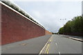
2

Walton Prison, Hornby Road.
Walton, Liverpool's second major prison, was built in the 1850's with an initial capacity for 1,000 inmates. In 1892 its predecessor, Kirkdale Gaol closed and its remaining inmates were walked along to their new home. One of the largest and most modern prisons in England in its day, it took both male and female prisoners who had been sentenced at the Liverpool Assizes. Liverpool became an Assize town in 1835 and in 1854 its famous St. George's Hall opened, becoming the venue for many famous trials. The photo shows Walton today with the 19th century tower still visible above the modern additions to the buildings.
Image: © Sue Adair
Taken: 14 Jan 2006
0.21 miles
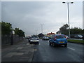
3
Beside HM Prison Liverpool
A category B/C local men's prison in Walton.
Looking north east on Hornby Road.
Image: © JThomas
Taken: 28 Apr 2019
0.23 miles