IMAGES TAKEN NEAR TO
The Calders, LIVERPOOL, L18 3LN
Introduction
This page details the photographs taken nearby to The Calders, L18 3LN by members of the Geograph project.
The Geograph project started in 2005 with the aim of publishing, organising and preserving representative images for every square kilometre of Great Britain, Ireland and the Isle of Man.

There are currently over 7.5m images from over14,400 individuals and you can help contribute to the project by visiting https://www.geograph.org.uk
Image Map
Images are licensed for reuse under creativecommons.org/licenses/by-sa/2.0
Notes
- Clicking on the map will re-center to the selected point.
- The higher the marker number, the further away the image location is from the centre of the postcode.
Image Listing (13 Images Found)
Images are licensed for reuse under creativecommons.org/licenses/by-sa/2.0
Image
Details
Distance
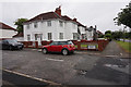
1
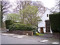
House enigmatically named Forty Pits on Glendyke Road
The house has a date of 1650 and rebuilt 1933 carved on the entrance stonework
Image: © Raymond Knapman
Taken: 24 Apr 2012
0.07 miles
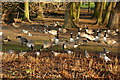
2
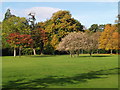
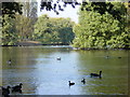
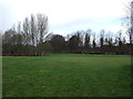
Autumn Colours - Calderstone Park
A variety of colours as the leaves change colours and fall.
Image: © Bernie Sullivan
Taken: 29 Oct 2006
0.16 miles
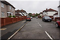
6
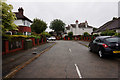
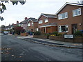
Gressingham Road off Mather Avenue, Liverpool
Image: © Ian S
Taken: 12 Jun 2019
0.21 miles