IMAGES TAKEN NEAR TO
Dudlow Lane, LIVERPOOL, L18 0HH
Introduction
This page details the photographs taken nearby to Dudlow Lane, L18 0HH by members of the Geograph project.
The Geograph project started in 2005 with the aim of publishing, organising and preserving representative images for every square kilometre of Great Britain, Ireland and the Isle of Man.

There are currently over 7.5m images from over14,400 individuals and you can help contribute to the project by visiting https://www.geograph.org.uk
Image Map
Images are licensed for reuse under creativecommons.org/licenses/by-sa/2.0
Notes
- Clicking on the map will re-center to the selected point.
- The higher the marker number, the further away the image location is from the centre of the postcode.
Image Listing (15 Images Found)
Images are licensed for reuse under creativecommons.org/licenses/by-sa/2.0
Image
Details
Distance
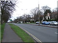
3
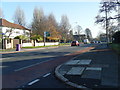
Woolton Road
Looking towards its junction with Queens Drive (Ring Road)
Image: © Colin Pyle
Taken: 9 Nov 2009
0.11 miles
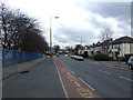
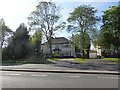
4
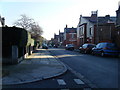
Dunbabin Road
Seen from its junction with Woodsorrel Road.
Image: © Colin Pyle
Taken: 9 Nov 2009
0.14 miles
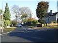
6
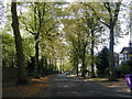
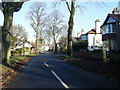
Dudlow Lane
Looking N from junction with Montclair Drive.
Image: © Colin Pyle
Taken: 5 Oct 2009
0.16 miles
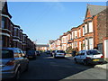
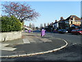
7
Rutherford Road
From the corner of Sinclair Drive.
Image: © Colin Pyle
Taken: 9 Nov 2009
0.16 miles