IMAGES TAKEN NEAR TO
Briarwood Road, LIVERPOOL, L17 6DH
Introduction
This page details the photographs taken nearby to Briarwood Road, L17 6DH by members of the Geograph project.
The Geograph project started in 2005 with the aim of publishing, organising and preserving representative images for every square kilometre of Great Britain, Ireland and the Isle of Man.

There are currently over 7.5m images from over14,400 individuals and you can help contribute to the project by visiting https://www.geograph.org.uk
Image Map
Images are licensed for reuse under creativecommons.org/licenses/by-sa/2.0
Notes
- Clicking on the map will re-center to the selected point.
- The higher the marker number, the further away the image location is from the centre of the postcode.
Image Listing (16 Images Found)
Images are licensed for reuse under creativecommons.org/licenses/by-sa/2.0
Image
Details
Distance
1
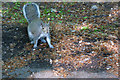
Old Boundary Marker
Parish Boundary Marker on the west side of Victoria Road, at the foot of a hedge between a gate to Aigburth House and a bus shelter. Liverpool metropolitan district. Inscribed G │W (for Garston and Wavertree). Showing the boundary of Garston and Wavertree townships' responsibility for road maintenance. Reference http://www.liverpool.ndo.co.uk/wavsoc/news20/index.html.
Milestone Society National ID: LA_LVGAWV01pb
Image: © M Chitty, Wavertree Society
Taken: 10 Aug 2018
0.07 miles
2
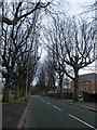
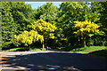
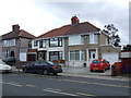
Tree lined Aigburth Vale, Liverpool
Nearby is Sefton Park.
Image: © Steve Fareham
Taken: 16 Mar 2012
0.14 miles
6

Save Sefton Park Meadows Poster on tree
All the trees at the edge of the meadows bordering Mossley Hill Drive had these posters campaigning to stop planning for building on the meadows
Image: © Martin Dawes
Taken: 21 Jun 2015
0.19 miles
7
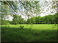
Sefton Park Meadows
There is a campaign to prevent building on these grass areas
Image: © Martin Dawes
Taken: 21 Jun 2015
0.19 miles
9
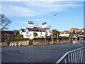
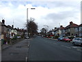
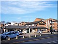
Five way junction at Aigburth Vale
Elmswood Road crosses from left to right. The prominent house has a Mediteranean look with several palm trees
Image: © Raymond Knapman
Taken: 19 Nov 2010
0.21 miles