IMAGES TAKEN NEAR TO
Swan Crescent, LIVERPOOL, L15 8AL
Introduction
This page details the photographs taken nearby to Swan Crescent, L15 8AL by members of the Geograph project.
The Geograph project started in 2005 with the aim of publishing, organising and preserving representative images for every square kilometre of Great Britain, Ireland and the Isle of Man.

There are currently over 7.5m images from over14,400 individuals and you can help contribute to the project by visiting https://www.geograph.org.uk
Image Map
Images are licensed for reuse under creativecommons.org/licenses/by-sa/2.0
Notes
- Clicking on the map will re-center to the selected point.
- The higher the marker number, the further away the image location is from the centre of the postcode.
Image Listing (34 Images Found)
Images are licensed for reuse under creativecommons.org/licenses/by-sa/2.0
Image
Details
Distance
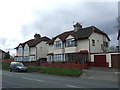
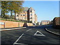
1
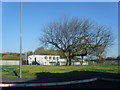
Manweb Sports and Social Club
Viewed from the end of Olive Mount Road. The land this side of the railings including the horse chestnut tree, was formerly the site of the Art annexe of Childwall Comprehensive School.
Image: © Colin Pyle
Taken: 9 Nov 2009
0.08 miles
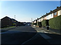
2
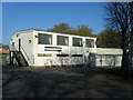
Manweb (Liverpool), Sports and Social Club.
Image: © Colin Pyle
Taken: 9 Nov 2009
0.09 miles
3
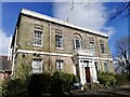
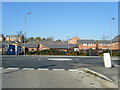
Olive Mount Children's Hospital
Olive Mount - whether this 18th century mansion gave its name to the hill on which it stood, or vice versa, is not known. It was built in the early 1790's for James Swan, a grocer and tea dealer, the location was, no doubt, chosen for its elevated position with views across open countryside. The house is typically Georgian in style and built of local cream sandstone.
In 1897 the estate was purchased by the Liverpool Select Vestry, for the building of Cottage Homes for the pauper children of Wavertree. Sixteen homes and two schools were built in the extensive grounds of Olive Mount and opened in 1901, later blocks were added for infants. When the Poor Law was abolished, the Olive Mount estate became a Children's Hospital, which after 1955 specialised in the care of people with learning difficulties. It was eventually closed and other than the original house, lodge and superintendent's house, virtually all of the buildings were demolished in 1991. More info and photographs:- http://www.workhouses.org.uk/Liverpool/
Image: © Sue Adair
Taken: 25 Mar 2021
0.10 miles
5
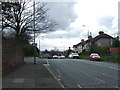
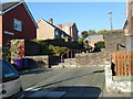
Olive Mount Road
Looking east at the development which replaced the multi-storey Olive Mount Heights.
Image: © Colin Pyle
Taken: 9 Nov 2009
0.11 miles