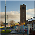
IMAGES TAKEN NEAR TO
Finch Road, LIVERPOOL, L14 4AT

Introduction

This page details the photographs taken nearby to Finch Road, L14 4AT by members of the Geograph project.

The Geograph project started in 2005 with the aim of publishing, organising and preserving representative images for every square kilometre of Great Britain, Ireland and the Isle of Man.

There are currently over 7.5m images from over14,400 individuals and you can help contribute to the project by visiting https://www.geograph.org.uk

Image Map


Images are licensed for reuse under creativecommons.org/licenses/by-sa/2.0
Notes
  • Clicking on the map will re-center to the selected point.
  • The higher the marker number, the further away the image location is from the centre of the postcode.

Image Listing (4 Images Found)

Images are licensed for reuse under creativecommons.org/licenses/by-sa/2.0
Image
Details
Distance
1
Yew Tree Health Centre
Image: © Sue Adair Taken: 8 Aug 2012
0.04 miles
2
Princess Drive/Finch Road junction
Image: © Colin Pyle Taken: 17 Sep 2010
0.04 miles
3
At first glance it looks as if the church is under new management
Image: © Ian Greig Taken: 22 Nov 2014
0.24 miles
4
Yew Tree Cemetery
Opened in 1893 Yew Tree is managed by Archdiocese of Liverpool. Yew Tree Cemetery has "public" and "private" graves. The public graves were not pauper graves but were paid for as single interments whereas private graves are family plots. Sections for public graves are usually in unmarked grassed areas and sections for private graves are more likely to have a gravestone but many do not. A plan is available at the following website: http://freepages.genealogy.rootsweb.ancestry.com/~hibernia/bur/yewcem.htm
Image: © Sue Adair Taken: 8 Aug 2012
0.24 miles