
IMAGES TAKEN NEAR TO
Muirhead Avenue, LIVERPOOL, L13 0BA
Introduction
This page details the photographs taken nearby to Muirhead Avenue, L13 0BA by members of the Geograph project.
The Geograph project started in 2005 with the aim of publishing, organising and preserving representative images for every square kilometre of Great Britain, Ireland and the Isle of Man.

There are currently over 7.5m images from over14,400 individuals and you can help contribute to the project by visiting https://www.geograph.org.uk
Image Map
Images are licensed for reuse under creativecommons.org/licenses/by-sa/2.0
Notes
- Clicking on the map will re-center to the selected point.
- The higher the marker number, the further away the image location is from the centre of the postcode.
Image Listing (10 Images Found)
Images are licensed for reuse under creativecommons.org/licenses/by-sa/2.0
Image
Details
Distance
1
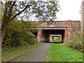
Muirhead Avenue bridges
Muirhead Avenue is one of those estate spine roads built as a dual carriageway in the interwar period when land was cheap. It crossed the railway line by a pair of bridges. Construction appears to be steel girders with concrete infill on brick piers. The railway line is now part of the Sustrans cycle/walking route. Image shows the far bridge from the road user's point of view.
Image: © Stephen Craven
Taken: 4 Nov 2017
0.05 miles
2

Liverpool Loop Line
Artwork on the Liverpool Loop Line.
Image: © Peter McDermott
Taken: 25 Jul 2025
0.05 miles
3

Muirhead Avenue
The Liverpool Loop Line passing under the two carriageways of Muirhead Avenue.
Image: © Peter McDermott
Taken: 25 Jul 2025
0.05 miles
4
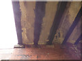
Muirhead Avenue northern bridge - detail
Construction of this road bridge appears to be steel girders with concrete infill on brick piers. The reinforced concrete is now spalling badly and it will only be a matter of time before the Council needs to take action. See Image for context.
Image: © Stephen Craven
Taken: 4 Nov 2017
0.06 miles
5
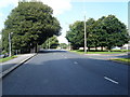
Muirhead Avenue
Looking towards the substantial bridges carrying the dual carriageway over the Loop Line cycle path.
Image: © Colin Pyle
Taken: 14 Aug 2010
0.08 miles
6
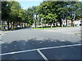
Muirhead Avenue East/Almonds Green junction
Image: © Colin Pyle
Taken: 14 Aug 2010
0.15 miles
7
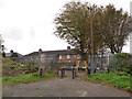
Access from NCN62 to Altham Road
One of the access points to/from the Sustrans route.
Image: © Stephen Craven
Taken: 4 Nov 2017
0.15 miles
8

Three Butt Lane
Bridge carrying Three Butt Lane over the Liverpool Loop Line.
Image: © Peter McDermott
Taken: 25 Jul 2025
0.18 miles
9
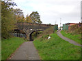
Three Butt Lane bridge
The bridge carries a road over a former railway line, now part of the Sustrans cycle/walking route.
Image: © Stephen Craven
Taken: 4 Nov 2017
0.19 miles
10
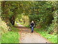
NCN62 north of Altham Road
Looking north-west towards Aintree.
Image: © Stephen Craven
Taken: 4 Nov 2017
0.21 miles