IMAGES TAKEN NEAR TO
Colinsburgh, LEVEN, KY9 1HP
Introduction
This page details the photographs taken nearby to KY9 1HP by members of the Geograph project.
The Geograph project started in 2005 with the aim of publishing, organising and preserving representative images for every square kilometre of Great Britain, Ireland and the Isle of Man.

There are currently over 7.5m images from over14,400 individuals and you can help contribute to the project by visiting https://www.geograph.org.uk
Image Map
Images are licensed for reuse under creativecommons.org/licenses/by-sa/2.0
Notes
- Clicking on the map will re-center to the selected point.
- The higher the marker number, the further away the image location is from the centre of the postcode.
Image Listing (13 Images Found)
Images are licensed for reuse under creativecommons.org/licenses/by-sa/2.0
Image
Details
Distance
2
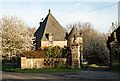
Gatehouse, Balniel
A redo of the first geograph for this square. This is one of the gate houses to Balcarres House.
Image: © Jim Bain
Taken: 26 Apr 2007
0.03 miles
3

Cattle grazing below Kilbrackmont Place
Image: © Richard Law
Taken: 26 Jun 2013
0.10 miles
4

Balniel
Balniel farm cottages and the B941 around 2000 metres south of Largoward.
Image: © Jim Bain
Taken: 26 Apr 2007
0.13 miles

6

Condensation, B941
A combination of Summer sunshine and Winter temperatures. The water from the previous shower has started to evaporate from the road only to condense as fog in cold air.
Image: © Richard Webb
Taken: 13 May 2013
0.15 miles
7

Road to Balniel
Farm road to Balniel from the Balcarres road looking towards Balniel Farm.
Image: © Jim Bain
Taken: 21 May 2007
0.16 miles