IMAGES TAKEN NEAR TO
Shotburn Crescent, LEVEN, KY8 4DU
Introduction
This page details the photographs taken nearby to Shotburn Crescent, KY8 4DU by members of the Geograph project.
The Geograph project started in 2005 with the aim of publishing, organising and preserving representative images for every square kilometre of Great Britain, Ireland and the Isle of Man.

There are currently over 7.5m images from over14,400 individuals and you can help contribute to the project by visiting https://www.geograph.org.uk
Image Map
Images are licensed for reuse under creativecommons.org/licenses/by-sa/2.0
Notes
- Clicking on the map will re-center to the selected point.
- The higher the marker number, the further away the image location is from the centre of the postcode.
Image Listing (14 Images Found)
Images are licensed for reuse under creativecommons.org/licenses/by-sa/2.0
Image
Details
Distance
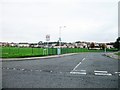
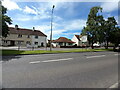
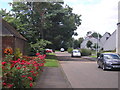
2
Houses on the NE side of the B933
The B933 Glenlyon Road is one of the main routes into and out of Leven town from the A915 Fife Coast Road.
Image: © Richard Law
Taken: 2 Jun 2024
0.13 miles
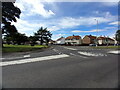
3
Houses on Glenlyon Road, south of Montrave Crescent
The B933 Glenlyon Road is one of the main routes into and out of Leven town from the A915 Fife Coast Road.
Image: © Richard Law
Taken: 2 Jun 2024
0.14 miles
4
Mountfleurie Street and houses to its north
Image: © Richard Law
Taken: 2 Jun 2024
0.15 miles
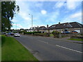
5
Houses on Middleton Place in Mountfleurie
Image: © Richard Law
Taken: 2 Jun 2024
0.17 miles
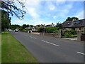
6
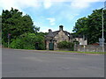
The former gatehouse, with associated walls & gatepiers, to Linnwood Hall
The gatehouse itself hides very effectively behind the walls and gateway. It was built around 1900 as a lodge house for the large Linnwood Hall, as yet unphotographed on this site, which lies roughly 250m NW of here, and the lodge & walls were Category C listed https://portal.historicenvironment.scot/designation/LB46509 & https://britishlistedbuildings.co.uk/200393838-lodge-house-linnwood-hall-leven-leven by Historic Scotland in 1999.
Image: © Richard Law
Taken: 2 Jun 2024
0.18 miles
7
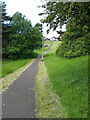
Pathway across parkland off Glenlyon Road
Image: © Richard Law
Taken: 2 Jun 2024
0.19 miles
8
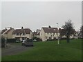
Housing Estate, Mountfleurie, Leven
Image: © Becky Williamson
Taken: 29 Nov 2020
0.20 miles
9
The road on the former railway line to Leven
The view from what appears to once have been the railway station at Leven. There appears to be no remains of the former railway station (as confirmed by the present occupant).
Image: © Sandy Gemmill
Taken: 9 Aug 2018
0.20 miles
10
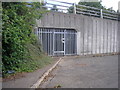
Underpass on Glen Lyon Road
This underpass appears to follow the route of the former railway line into Leven. Unfortunately the underpass is not in use and there is a locked entrance to the underpass.
Image: © Sandy Gemmill
Taken: 9 Aug 2018
0.22 miles