IMAGES TAKEN NEAR TO
Jubilee Gardens, GLENROTHES, KY7 6QF

Introduction

This page details the photographs taken nearby to Jubilee Gardens, KY7 6QF by members of the Geograph project.

The Geograph project started in 2005 with the aim of publishing, organising and preserving representative images for every square kilometre of Great Britain, Ireland and the Isle of Man.

There are currently over 7.5m images from over14,400 individuals and you can help contribute to the project by visiting https://www.geograph.org.uk

Image Map


Images are licensed for reuse under creativecommons.org/licenses/by-sa/2.0
Notes
  • Clicking on the map will re-center to the selected point.
  • The higher the marker number, the further away the image location is from the centre of the postcode.

Image Listing (25 Images Found)

Images are licensed for reuse under creativecommons.org/licenses/by-sa/2.0
  • ...
Image
Details
Distance
1
View over Fife countryside
From the outskirts of Markinch we look over the A911 towards Milton of Balgonie. On the extreme left of the image can just be made out the wind turbine at Fife Energy Park in Methil Image A line of similar wind turbines can be seen running across the centre of the image. These belong to the Earl's Seat Wind Farm which is accessed from the A915 Standing Stane Road Image
Image: © Bill Kasman Taken: 6 Jun 2020
0.06 miles
2
Milton of Balgonie, Fife
Looking east down the main street of this small village between Glenrothes and Windygates.
Image: © Kevin Rae Taken: 20 Feb 2006
0.08 miles
3
Milton of Balgonie School
Image: © Becky Williamson Taken: 17 Nov 2019
0.10 miles
4
Pink Bungalow
On the Main Street of Milton of Balgonie.
Image: © Paul McIlroy Taken: 19 Apr 2007
0.11 miles
5
Milton Church
The church in the former flax-milling town of Milton of Balgonie
Image: © James Allan Taken: 19 Feb 2006
0.12 miles
6
River bank path
On the path along the south side of the River Leven near Milton of Balgonie this diesel-powered pump was drawing water from the river and pumping it several hundred yards uphill to the right where it was being used to irrigate potato fields.
Image: © Bill Kasman Taken: 15 Jul 2020
0.15 miles
7
Housing
Housing in Milton of Balgonie viewed from the track leading to Balfour Mains.
Image: © Paul McIlroy Taken: 19 Apr 2007
0.16 miles
8
River bank path
The path along the south side of the River Leven near Milton of Balgonie. The bench seat was very welcome! There is a curious collection of objects next to the seat Image
Image: © Bill Kasman Taken: 15 Jul 2020
0.16 miles
9
River bank path
This curious collection of garden gnomes, fairies and other small ornaments was on the bank of the River Leven near Milton of Balgonie. There was no explanation of who was responsible or why.
Image: © Bill Kasman Taken: 15 Jul 2020
0.16 miles
10
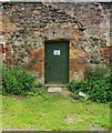
Door in walled garden
Near Milton of Balgonie the former walled garden of Balfour House (now derelict) is being used by the local farmer as an apiary. This door leads to a shed which is involved in the collection of honey.
Image: © Bill Kasman Taken: 15 Jul 2020
0.16 miles
  • ...