IMAGES TAKEN NEAR TO
Milton Of Balgonie, GLENROTHES, KY7 6QE

Introduction

This page details the photographs taken nearby to KY7 6QE by members of the Geograph project.

The Geograph project started in 2005 with the aim of publishing, organising and preserving representative images for every square kilometre of Great Britain, Ireland and the Isle of Man.

There are currently over 7.5m images from over14,400 individuals and you can help contribute to the project by visiting https://www.geograph.org.uk

Image Map


Images are licensed for reuse under creativecommons.org/licenses/by-sa/2.0
Notes
  • Clicking on the map will re-center to the selected point.
  • The higher the marker number, the further away the image location is from the centre of the postcode.

Image Listing (33 Images Found)

Images are licensed for reuse under creativecommons.org/licenses/by-sa/2.0
  • ...
Image
Details
Distance
1
Abandoned house
Near Milton of Balgonie. It is boarded-up and, surprisingly, shows no signs of vandalism.
Image: © Bill Kasman Taken: 15 Jul 2020
0.00 miles
2
Abandoned house
Near Milton of Balgonie. It is boarded-up and, surprisingly, shows no signs of vandalism.
Image: © Bill Kasman Taken: 15 Jul 2020
0.00 miles
3
Walled garden
The north-west corner.
Image: © Bill Kasman Taken: 15 Jul 2020
0.03 miles
4
Walled garden
This is the west wall of the former walled garden of Balfour House (now derelict). The local farmer uses it as an apiary for the production of honey.
Image: © Bill Kasman Taken: 15 Jul 2020
0.04 miles
5
River bank path
The path along the south side of the River Leven near Milton of Balgonie. The bench seat was very welcome! There is a curious collection of objects next to the seat Image
Image: © Bill Kasman Taken: 15 Jul 2020
0.04 miles
6
River bank path
This curious collection of garden gnomes, fairies and other small ornaments was on the bank of the River Leven near Milton of Balgonie. There was no explanation of who was responsible or why.
Image: © Bill Kasman Taken: 15 Jul 2020
0.04 miles
7
Walled garden
Looking along the west wall of the garden.
Image: © Bill Kasman Taken: 15 Jul 2020
0.04 miles
8
Public path
Near Milton of Balgonie this path passes the former walled garden of the (derelict) Balfour House.
Image: © Bill Kasman Taken: 15 Jul 2020
0.05 miles
9
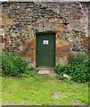
Door in walled garden
Near Milton of Balgonie the former walled garden of Balfour House (now derelict) is being used by the local farmer as an apiary. This door leads to a shed which is involved in the collection of honey.
Image: © Bill Kasman Taken: 15 Jul 2020
0.06 miles
10
Walled garden
This is the south-west corner of the former walled garden of Balfour House (now derelict) showing the garden cottage. The ruins of Balfour House are in the trees on the extreme right of the image https://www.geograph.org.uk/photo/6565485
Image: © Bill Kasman Taken: 15 Jul 2020
0.06 miles
  • ...