IMAGES TAKEN NEAR TO
Milton Of Balgonie, GLENROTHES, KY7 6QD

Introduction

This page details the photographs taken nearby to KY7 6QD by members of the Geograph project.

The Geograph project started in 2005 with the aim of publishing, organising and preserving representative images for every square kilometre of Great Britain, Ireland and the Isle of Man.

There are currently over 7.5m images from over14,400 individuals and you can help contribute to the project by visiting https://www.geograph.org.uk

Image Map


Images are licensed for reuse under creativecommons.org/licenses/by-sa/2.0
Notes
  • Clicking on the map will re-center to the selected point.
  • The higher the marker number, the further away the image location is from the centre of the postcode.

Image Listing (16 Images Found)

Images are licensed for reuse under creativecommons.org/licenses/by-sa/2.0
Image
Details
Distance
1
Balfour Place, Milton of Balgonie
This was once a main road but is now part of a well-used pedestrian and cycle path which crosses the busy A911 at this point.
Image: © Bill Kasman Taken: 18 Jun 2020
0.04 miles
2
Balfour Place, Milton of Balgonie
Of the three plates on this post the top two are self-explanatory but the meaning of the bottom one isn't so obvious. It consists of the entwined letters 'P' and 'C' and indicates that this path is a combined pedestrian footpath and cycle way.
Image: © Bill Kasman Taken: 18 Jun 2020
0.04 miles
3
Balfour Place, Milton of Balgonie
Now part of a well-used pedestrian and cycle path Balfour Place was once a main road evidence of which can be seen in the remains of the centre white line and cat's eye road studs.
Image: © Bill Kasman Taken: 18 Jun 2020
0.05 miles
4
Old road alignment, Milton of Balgonie
Milton of Balgonie has a bypass - the A915 has been modernised between Glenrothes and Leven. This old bit of road is now a cycle path.
Image: © Richard Webb Taken: 15 May 2012
0.08 miles
5
Balfour Place, Milton of Balgonie
This was once a main road but is now a pedestrian and cycle path.
Image: © Bill Kasman Taken: 18 Jun 2020
0.09 miles
6
Whinnie Bank
A green lane descends to Rosebank and the busy A915.
Image: © Richard Webb Taken: 15 May 2012
0.09 miles
7
Balfour Place, Milton of Balgonie
The A911 heads for Glenrothes. On the left the pedestrian and cycle path of Balfour Place was once the main road.
Image: © Bill Kasman Taken: 18 Jun 2020
0.11 miles
8
Young cereal crop, Milton of Balgonie
Image: © Richard Webb Taken: 27 Feb 2011
0.13 miles
9
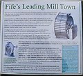
Water wheel sculpture
Part of a water wheel used to power mill machinery, this structure stands by the road just outside Milton of Balgonie. It represents the mill history of the village. The attached plaque can be seen here Image
Image: © Bill Kasman Taken: 18 Jun 2020
0.16 miles
10
Plaque on sculpture
This plaque is affixed to the water wheel sculpture in this image Image
Image: © Bill Kasman Taken: 18 Jun 2020
0.16 miles