IMAGES TAKEN NEAR TO
Brunton Park, GLENROTHES, KY7 6EZ

Introduction

This page details the photographs taken nearby to Brunton Park, KY7 6EZ by members of the Geograph project.

The Geograph project started in 2005 with the aim of publishing, organising and preserving representative images for every square kilometre of Great Britain, Ireland and the Isle of Man.

There are currently over 7.5m images from over14,400 individuals and you can help contribute to the project by visiting https://www.geograph.org.uk

Image Map


Images are licensed for reuse under creativecommons.org/licenses/by-sa/2.0
Notes
  • Clicking on the map will re-center to the selected point.
  • The higher the marker number, the further away the image location is from the centre of the postcode.

Image Listing (82 Images Found)

Images are licensed for reuse under creativecommons.org/licenses/by-sa/2.0
  • ...
Image
Details
Distance
1
Markinch and East Lomond
From the minor road which leaves Markinch at the railway station.
Image: © Bill Kasman Taken: 6 Jun 2020
0.05 miles
2
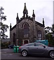
Brunton Court, High Street, Markinch
A Free Church of Scotland from 1843 to 1900 (being then amalgamated within the United Free Church); later converted to residential flats in 1994. See http://www.scottishchurches.org.uk/sites/site/id/1387/name/Brunton+Church+Markinch+Fife
Image: © Stanley Howe Taken: 7 Oct 2015
0.06 miles
3
Markinch and Lomond Hills
From the public path which leads to Star of Markinch Image West Lomond (on the left) and East Lomond (Falkland Hill) are the two hills.
Image: © Bill Kasman Taken: 6 Jun 2020
0.06 miles
4
Converted Church, Markinch
Image: © JThomas Taken: 22 Oct 2013
0.07 miles
5
Edinburgh train
The 1030 Dundee to Edinburgh service arrives at Markinch station formed of locomotive and stock. Nowadays these services are all formed by diesel units.
Image: © roger geach Taken: 10 May 1985
0.07 miles
6
The view northbound from Markinch station
Image: © Tom Page Taken: 28 Jun 2008
0.09 miles
7
Glass Street, then High Street
Looking south from the churchyard.
Image: © M J Richardson Taken: 30 Oct 2009
0.10 miles
8
The Braes Loan Trail
At the end of Brunton Road, Markinch, this railway bridge, which carries the east coast main line, tells us we are approaching the beginning of one end of the Braes Loan Trail http://www.markinchheritage.org.uk/index.asp?MainID=29134 You can follow the Braes Loan Trail as a GeoTrip http://www.geograph.org.uk/geotrips/1672
Image: © Bill Kasman Taken: 25 Jun 2020
0.10 miles
9
The Braes Loan Trail
Through the arch to Markinch. The main east coast railway line passes over this arch.
Image: © Bill Kasman Taken: 25 Jun 2020
0.11 miles
10
Station House, Markinch
Dating from when the station was opened in 1847 and now belonging to Network Rail this B-listed building is the former station master's house and ticket office for Markinch Railway Station. It has been disused for some time and is in a poor condition. It is being partially renovated to resist further deterioration. This involves the installation of central heating and the architecturally sympathetic renovation of the roof and certain exterior features. https://www.geograph.org.uk/photo/4794651
Image: © Bill Kasman Taken: 27 Feb 2021
0.11 miles
  • ...