IMAGES TAKEN NEAR TO
Laurel Bank Drive, GLENROTHES, KY7 6DG

Introduction

This page details the photographs taken nearby to Laurel Bank Drive, KY7 6DG by members of the Geograph project.

The Geograph project started in 2005 with the aim of publishing, organising and preserving representative images for every square kilometre of Great Britain, Ireland and the Isle of Man.

There are currently over 7.5m images from over14,400 individuals and you can help contribute to the project by visiting https://www.geograph.org.uk

Image Map


Images are licensed for reuse under creativecommons.org/licenses/by-sa/2.0
Notes
  • Clicking on the map will re-center to the selected point.
  • The higher the marker number, the further away the image location is from the centre of the postcode.

Image Listing (83 Images Found)

Images are licensed for reuse under creativecommons.org/licenses/by-sa/2.0
  • ...
Image
Details
Distance
1
Markinch from the Kirk
Looking south to the back of houses and shops on Balbirnie Street, and houses on Kirk Brae in the foreground..
Image: © M J Richardson Taken: 30 Oct 2009
0.04 miles
2
Glass Street, then High Street
Looking south from the churchyard.
Image: © M J Richardson Taken: 30 Oct 2009
0.04 miles
3
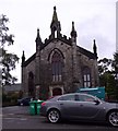
Converted Church, Markinch
Image: © JThomas Taken: 22 Oct 2013
0.05 miles
4
Brunton Court, High Street, Markinch
A Free Church of Scotland from 1843 to 1900 (being then amalgamated within the United Free Church); later converted to residential flats in 1994. See http://www.scottishchurches.org.uk/sites/site/id/1387/name/Brunton+Church+Markinch+Fife
Image: © Stanley Howe Taken: 7 Oct 2015
0.05 miles
5
Markinch
High Street (left) and Balbirnie Street.
Image: © Richard Webb Taken: 15 May 2012
0.05 miles
6
Markinch High Street
A bakers and cafe on the corner with Balbirnie Street.
Image: © Richard Webb Taken: 26 Apr 2013
0.05 miles
7
Markinch, Fife.
Balbirnie Street.
Image: © James Denham Taken: 13 Sep 2008
0.06 miles
8
Markinch Parish Kirk from the High Street
Image: © kim traynor Taken: 10 Sep 2013
0.08 miles
9
Markinch and East Lomond
From the minor road which leaves Markinch at the railway station.
Image: © Bill Kasman Taken: 6 Jun 2020
0.10 miles
10
Floodlit St Drostan's Church in Markinch
A floodlit St Drostan's Church dominates the night sky in Markinch with the photo also showing Bailey's Wynd leading eastward from Commercial Street towards the church. Hastie's the butcher shop is pictured on the left.
Image: © John Honeyman Taken: 30 Jan 2008
0.11 miles
  • ...