IMAGES TAKEN NEAR TO
Muirtonhill Road, LOCHGELLY, KY5 0NN

Introduction

This page details the photographs taken nearby to Muirtonhill Road, KY5 0NN by members of the Geograph project.

The Geograph project started in 2005 with the aim of publishing, organising and preserving representative images for every square kilometre of Great Britain, Ireland and the Isle of Man.

There are currently over 7.5m images from over14,400 individuals and you can help contribute to the project by visiting https://www.geograph.org.uk

Image Map


Images are licensed for reuse under creativecommons.org/licenses/by-sa/2.0
Notes
  • Clicking on the map will re-center to the selected point.
  • The higher the marker number, the further away the image location is from the centre of the postcode.

Image Listing (13 Images Found)

Images are licensed for reuse under creativecommons.org/licenses/by-sa/2.0
Image
Details
Distance
1
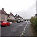
Muirtonhill Road
Woodend.
Image: © Richard Webb Taken: 25 Jan 2020
0.02 miles
2
Woodend Park
Image: © Richard Webb Taken: 25 Jan 2020
0.05 miles
3
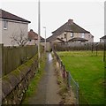
Path, Woodend
Between Muirtonhill Road and Woodend Park. Watch where you put your feet!
Image: © Richard Webb Taken: 25 Jan 2020
0.05 miles
4
Woodend Road
Image: © Richard Webb Taken: 25 Jan 2020
0.06 miles
5
Path, Woodend
Crossing a field to the road serving the golf course.
Image: © Richard Webb Taken: 25 Jan 2020
0.07 miles
6
Old keep out sign, Woodend
At first it's a bit of a puzzle - construction? What they were building was the hill in the background which is entirely man made after opencast mining operations.
Image: © Richard Webb Taken: 25 Jan 2020
0.08 miles
7
Burma Road
A survivor of the huge opencast mining operation which has left a new hill to the north.
Image: © Richard Webb Taken: 25 Jan 2020
0.11 miles
8
Woodend Road
The B921, Woodend.
Image: © Richard Webb Taken: 25 Jan 2020
0.11 miles
9
Derelict site off Woodend Road
A building has been demolished here, prior to 2009. The for sale board is falling to bits.
Image: © Richard Webb Taken: 25 Jan 2020
0.11 miles
10
The old B921
This road has been rerouted and removed somewhere along its length. Almost certainly due to open cast coal mining.
Image: © Richard Webb Taken: 20 Jan 2012
0.12 miles