IMAGES TAKEN NEAR TO
Woodend Business Centre, COWDENBEATH, KY4 8HG

Introduction

This page details the photographs taken nearby to Woodend Business Centre, KY4 8HG by members of the Geograph project.

The Geograph project started in 2005 with the aim of publishing, organising and preserving representative images for every square kilometre of Great Britain, Ireland and the Isle of Man.

There are currently over 7.5m images from over14,400 individuals and you can help contribute to the project by visiting https://www.geograph.org.uk

Image Map


Images are licensed for reuse under creativecommons.org/licenses/by-sa/2.0
Notes
  • Clicking on the map will re-center to the selected point.
  • The higher the marker number, the further away the image location is from the centre of the postcode.

Image Listing (7 Images Found)

Images are licensed for reuse under creativecommons.org/licenses/by-sa/2.0
Image
Details
Distance
1
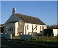
Converted Church
Situated in Hill O' Beath this church has been converted to a dwelling.
Image: © Paul McIlroy Taken: 12 Dec 2005
0.11 miles
2
Housing.
Looking eastwards across the roofs of a Cowdenbeath housing estate to Moss Morran Chemical Works.
Image: © Paul McIlroy Taken: 12 Dec 2005
0.11 miles
3
B981
Approaching Cowdenbeath.
Image: © Richard Webb Taken: 4 Jul 2009
0.19 miles
4
In the thick of it
Thick woodland near Cowdenbeath. Many trees have been cut down in the woods.
Image: © James Denham Taken: 26 Apr 2010
0.21 miles
5
Dilapidated building
Building undergoing repairs in Hill of Beath a former mining village near Cowdenbeath
Image: © Paul McIlroy Taken: 13 Jan 2009
0.23 miles
6
Cowdenbeath Woodend
Community woodland to the south of Cowdenbeath.
Image: © Richard Webb Taken: 4 Jul 2009
0.24 miles
7
Torbeath Gardens, Hill of Beath
Striking roofs on the houses here.
Image: © Richard Webb Taken: 26 Nov 2011
0.25 miles