IMAGES TAKEN NEAR TO
Viewfield Terrace, COWDENBEATH, KY4 8AB

Introduction

This page details the photographs taken nearby to Viewfield Terrace, KY4 8AB by members of the Geograph project.

The Geograph project started in 2005 with the aim of publishing, organising and preserving representative images for every square kilometre of Great Britain, Ireland and the Isle of Man.

There are currently over 7.5m images from over14,400 individuals and you can help contribute to the project by visiting https://www.geograph.org.uk

Image Map


Images are licensed for reuse under creativecommons.org/licenses/by-sa/2.0
Notes
  • Clicking on the map will re-center to the selected point.
  • The higher the marker number, the further away the image location is from the centre of the postcode.

Image Listing (6 Images Found)

Images are licensed for reuse under creativecommons.org/licenses/by-sa/2.0
Image
Details
Distance
1
Semi detached houses in Lumphinnans, Fife
Situated on Lumphinnans Road between Lochgelly and Cowdenbeath.
Image: © James Denham Taken: 26 Apr 2010
0.06 miles
2
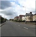
The B981 heading towards Cowdenbeath in Fife
Through Lumphinnans.
Image: © James Denham Taken: 26 Apr 2010
0.08 miles
3
Lumphinnans Road, Lochgelly
Image: © Richard Webb Taken: 5 Sep 2021
0.19 miles
4
Lumphinnans Road, Lochgelly
Image: © Richard Webb Taken: 5 Sep 2021
0.20 miles
5
Gagarin Way.
The former mining village of Lumphinnans which is situated to the east of Cowdenbeath is known locally as 'Little Moscow' because it is a small but staunch bastion of Communism, even to the extent of always electing a communist to the local council and naming its streets after heroes of The Soviet Union.
Image: © Paul McIlroy Taken: 12 Dec 2005
0.22 miles
6
Community housing in Lochgelly, Fife
The houses are situated on the Lochgelly to Lumphinnans road.
Image: © James Denham Taken: 26 Apr 2010
0.22 miles