IMAGES TAKEN NEAR TO
Kinghorn Road, BURNTISLAND, KY3 9LH

Introduction

This page details the photographs taken nearby to Kinghorn Road, KY3 9LH by members of the Geograph project.

The Geograph project started in 2005 with the aim of publishing, organising and preserving representative images for every square kilometre of Great Britain, Ireland and the Isle of Man.

There are currently over 7.5m images from over14,400 individuals and you can help contribute to the project by visiting https://www.geograph.org.uk

Image Map


Images are licensed for reuse under creativecommons.org/licenses/by-sa/2.0
Notes
  • Clicking on the map will re-center to the selected point.
  • The higher the marker number, the further away the image location is from the centre of the postcode.

Image Listing (36 Images Found)

Images are licensed for reuse under creativecommons.org/licenses/by-sa/2.0
  • ...
Image
Details
Distance
1
Cemetery entrance at dawn
Image: © Alan Reid Taken: 12 Nov 2022
0.01 miles
2
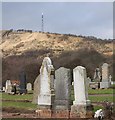
Burntisland Cemetery
Burntisland Cemetery, The Binn and Craigkelly television transmitter mast.
Image: © Paul McIlroy Taken: 4 Feb 2008
0.01 miles
3
Cemetery, Burntisland
Off Kinghorn Road.
Image: © Richard Webb Taken: 5 Sep 2009
0.02 miles
4
High Speed Train approaches Burntisland...
...as viewed from Lammerlaws Point, some 1000 metres away.
Image: © Bill Harrison Taken: 19 Apr 2023
0.03 miles
5
Burntisland Sands
A not entirely satisfactory low-tide alternative to the not entirely satisfactory high-tide route of the Fife Coast Path which follows the A921. There is a narrow sandy strip sandwiched between the piles of rock backing up the concrete railway embankment to the right, and a large expanse of very wet sand to the left. Burntisland town beyond with the Erskine Church Image prominent.
Image: © Oliver Dixon Taken: 23 Mar 2022
0.04 miles
6
Tunnel under the railway
This tunnel under the railway connects the beach at Burntisland Bay with the main A921 road. It can form a useful escape route from the beach at high tide but is quite difficult to access.
Image: © Oliver Dixon Taken: 23 Mar 2022
0.05 miles
7
Coastal railway heading west
Towards Burntisland.
Image: © JThomas Taken: 3 Jul 2013
0.06 miles
8
Towards Burntisland
From the railway.
Image: © Andrew Abbott Taken: 13 Nov 2022
0.06 miles
9
Firth of Forth
Image: © N Chadwick Taken: 29 Jul 2022
0.07 miles
10
Beach east of Burntisland
The tide is about to flood the last bit of exposed beach. Opportunities to leave the beach are few due to the railway, so care is needed with the tides.
Image: © Richard Webb Taken: 5 Sep 2009
0.07 miles
  • ...