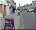
IMAGES TAKEN NEAR TO
High Street, BURNTISLAND, KY3 9AP

Introduction

This page details the photographs taken nearby to High Street, KY3 9AP by members of the Geograph project.

The Geograph project started in 2005 with the aim of publishing, organising and preserving representative images for every square kilometre of Great Britain, Ireland and the Isle of Man.

There are currently over 7.5m images from over14,400 individuals and you can help contribute to the project by visiting https://www.geograph.org.uk

Image Map


Images are licensed for reuse under creativecommons.org/licenses/by-sa/2.0
Notes
  • Clicking on the map will re-center to the selected point.
  • The higher the marker number, the further away the image location is from the centre of the postcode.

Image Listing (155 Images Found)

Images are licensed for reuse under creativecommons.org/licenses/by-sa/2.0
  • ...
Image
Details
Distance
1
High Street, Burntisland
Looking east.
Image: © Richard Sutcliffe Taken: 28 Sep 2019
0.01 miles
2
Kingdom Amusements
A family-run amusement arcade located on High Street, Burntisland. The dog looks like he wants to go in and play the slot machines...
Image: © Richard Sutcliffe Taken: 28 Sep 2019
0.02 miles
3
Burntisland High Street
Image: © Mat Fascione Taken: 22 Jul 2019
0.04 miles
4
Burntisland Town Hall
The present town hall was built in 1843, replacing an earlier building on the site.
Image: © Robert Struthers Taken: 4 Jun 2017
0.04 miles
5
Kings, Queens & Cromwell
An information panel situated between the High Street and Union Street. Installed by Burntisland Heritage Trust in 2009 https://burntisland.net/heritage-trust-panels.htm
Image: © Michael Booth Taken: 10 Jun 2021
0.04 miles
6
Sundials
These three sundials are built into the stone work above the second floor windows on the Porte Building at the east end of Burntisland High Street.
Image: © Paul McIlroy Taken: 2 Jun 2007
0.05 miles
7
High Street, Burntisland
Looking west.
Image: © Richard Sutcliffe Taken: 28 Sep 2019
0.05 miles
8
Shop window, Burntisland
A note in the window states that it is being renovated, as a shop downstairs and dance studio upstairs.
Image: © Richard Webb Taken: 25 Apr 2009
0.06 miles
9
David Danskin commemoration plaque
Installed by Burntisland Heritage Trust in 2007 https://www.burntisland.net/danskin-plaque.htm
Image: © Michael Booth Taken: 17 Apr 2021
0.06 miles
10
The original stone doorway of Coupar Kirk, Burntisland
The former Free Church of Scotland was built in 1843, but stopped functioning in 1861. It continued to operate as a community hall until 1977, when it was gutted by fire. In 1986, the burnt out shell was taken down, leaving just the original stone doorway, re-built belfry and some lower church walls. The doorway is opposite the present Burntisland Parish Church.
Image: © Becky Williamson Taken: 13 Apr 2019
0.06 miles
  • ...