IMAGES TAKEN NEAR TO
Manse Lane, BURNTISLAND, KY3 0BJ

Introduction

This page details the photographs taken nearby to Manse Lane, KY3 0BJ by members of the Geograph project.

The Geograph project started in 2005 with the aim of publishing, organising and preserving representative images for every square kilometre of Great Britain, Ireland and the Isle of Man.

There are currently over 7.5m images from over14,400 individuals and you can help contribute to the project by visiting https://www.geograph.org.uk

Image Map


Images are licensed for reuse under creativecommons.org/licenses/by-sa/2.0
Notes
  • Clicking on the map will re-center to the selected point.
  • The higher the marker number, the further away the image location is from the centre of the postcode.

Image Listing (103 Images Found)

Images are licensed for reuse under creativecommons.org/licenses/by-sa/2.0
  • ...
Image
Details
Distance
1
High Street pend, Burntisland
Image: © kim traynor Taken: 20 Apr 2011
0.07 miles
2
Pseudo-Tudor houses
In Cromwell Road, Burntisland.
Image: © James Allan Taken: 5 Sep 2016
0.08 miles
3
Building in Rose Street, Burntisland
This striking building, apparently divided into apartments, has an art deco look to it, but I have been unable to discover any more details.
Image: © Oliver Dixon Taken: 23 Mar 2022
0.08 miles
4
Cromwell Road
Substantial stone houses with a view over the Links.
Image: © Richard Webb Taken: 25 Apr 2009
0.08 miles
5
Burntisland War Memorial
Burntisland war memorial at the junction of Cromwell Road and Kinghorn Road.
Image: © Robert Struthers Taken: 4 Jun 2017
0.08 miles
6
Outside a cafe, Burntisland
A water bowl, thoughtfully left for dogs left outside.
Image: © Richard Webb Taken: 25 Apr 2009
0.08 miles
7
Porte Buildings
Built in 1899 near the site of the east porte or gate to the town which was the main entrance from 1635.
Image: © Jim Smillie Taken: 15 Jun 2009
0.09 miles
8
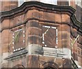
Sundial, Burntisland
On a turret of The Old Port at the end of the High Street.
Image: © Richard Webb Taken: 5 Sep 2009
0.10 miles
9
East Port Buildings, Burntisland High Street
The East Port Buildings (also known as New Porte and East Porte) built in 1899, designed by Swanston and Legge Architects in the Flemish style. This photograph, taken in October 2002, shows Macari's ice-cream parlour (previously Verracchia's) closed down and the shop unit empty. The ice-cream parlour featured in the children's book 'Maisie's Mystery Tour' was based on this one.
Image: © Jennifer Brown Taken: 9 Oct 2002
0.10 miles
10
High Street before dawn
Image: © Alan Reid Taken: 12 Nov 2022
0.10 miles
  • ...