IMAGES TAKEN NEAR TO
The Barns, BURNTISLAND, KY3 0BD

Introduction

This page details the photographs taken nearby to The Barns, KY3 0BD by members of the Geograph project.

The Geograph project started in 2005 with the aim of publishing, organising and preserving representative images for every square kilometre of Great Britain, Ireland and the Isle of Man.

There are currently over 7.5m images from over14,400 individuals and you can help contribute to the project by visiting https://www.geograph.org.uk

Image Map


Images are licensed for reuse under creativecommons.org/licenses/by-sa/2.0
Notes
  • Clicking on the map will re-center to the selected point.
  • The higher the marker number, the further away the image location is from the centre of the postcode.

Image Listing (146 Images Found)

Images are licensed for reuse under creativecommons.org/licenses/by-sa/2.0
  • ...
Image
Details
Distance
1
Site of the former tollbooth, Burntisland
Nothing now remains of the building where 224 Covenanters were imprisoned in May 1685 in deplorable conditions, packed into two rooms in the tollbooth without food or water. They had been shipped to the town from Leith They were then marched all the way to Dunnottar Castle near Stonehaven. For more information, see https://www.burntisland.net/churches-article4.htm.
Image: © Becky Williamson Taken: 13 Apr 2019
0.04 miles
2
Burntisland High Street
Looking west along the High Street to Burntisland Railway Viaduct. Image
Image: © Paul McIlroy Taken: 2 Jun 2007
0.04 miles
3
Silver Tassie
Bar, Burntisland High Street.
Image: © Richard Webb Taken: 25 Apr 2009
0.05 miles
4
Railway cutting below West Broomhill Road
The slope has been heavily netted to prevent rock falls.
Image: © Oliver Dixon Taken: 23 Mar 2022
0.06 miles
5
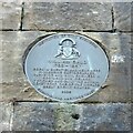
William Bald commemoration plaque
Installed by Burntisland Heritage Trust in 2008 https://www.burntisland.net/bald-plaque.htm
Image: © Michael Booth Taken: 17 Apr 2021
0.07 miles
6
17thC houses in Somerville Square, Burntisland
'Watson's West Tenement', bequeathed to the town by John Watson in about 1769 to provide three widows with rent-free accommodation; and still fulfils its original purpose today.
Image: © kim traynor Taken: 20 Apr 2011
0.07 miles
7
Railway Bridge, Burntisland
There is an Ordnance Survey benchmark on this bridge.
Image: © Becky Williamson Taken: 13 Apr 2019
0.07 miles
8
Burntisland viaduct
Burntisland viaduct and Harbour House Image
Image: © Paul McIlroy Taken: 3 May 2007
0.07 miles
9
Burntisland Viaduct
Image: © kim traynor Taken: 20 Apr 2011
0.07 miles
10
17thC houses in Somerville Square, Burntisland
Image: © kim traynor Taken: 20 Apr 2011
0.07 miles
  • ...