IMAGES TAKEN NEAR TO
Armit Place, ST. ANDREWS, KY16 8RE
Introduction
This page details the photographs taken nearby to Armit Place, KY16 8RE by members of the Geograph project.
The Geograph project started in 2005 with the aim of publishing, organising and preserving representative images for every square kilometre of Great Britain, Ireland and the Isle of Man.

There are currently over 7.5m images from over14,400 individuals and you can help contribute to the project by visiting https://www.geograph.org.uk
Image Map
Images are licensed for reuse under creativecommons.org/licenses/by-sa/2.0
Notes
- Clicking on the map will re-center to the selected point.
- The higher the marker number, the further away the image location is from the centre of the postcode.
Image Listing (30 Images Found)
Images are licensed for reuse under creativecommons.org/licenses/by-sa/2.0
Image
Details
Distance
1
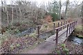
Bridge, Cairnsmill Burn
Paths following burns in St Andrews.
Image: © Richard Webb
Taken: 8 Jan 2017
0.06 miles
3
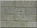
Benchmark on wall, Aikman Place, St Andrews
Ordnance Survey benchmark, described on database at https://www.bench-marks.org.uk/bm138903. See also Image
Image: © Becky Williamson
Taken: 10 Jul 2021
0.07 miles
4
Wall at Aikman Place, St Andrews
There is an Ordnance Survey benchmark on this wall. See Image
Image: © Becky Williamson
Taken: 10 Jul 2021
0.07 miles
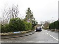
5
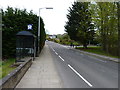
Bogward Road
At the Windsor Gardens bus stop.
Image: © James Allan
Taken: 6 May 2013
0.07 miles
6
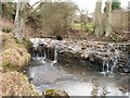
Bogward
A small weir on a tributary burn where it joins with the Cairnsmill Burn at Bogward
Image: © Jim Bain
Taken: 19 Mar 2006
0.08 miles
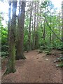
7

Late Spring by the Kinness Burn
This arboretum is secluded at the west end of the Ladebraes walk, which stretches along the Kinness Burn right through the town of St Andrews. Most of these trees are planted as memorials.
Image: © Iain McDonald
Taken: 10 May 2005
0.14 miles
8
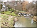
Law Mill, St Andrews
Looking up stream by Law Mill
Image: © Jim Bain
Taken: 19 Mar 2006
0.14 miles
9
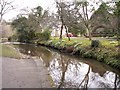
Law Mill, St Andrews
Looking down the Kinness Burn to Law Mill
Image: © Jim Bain
Taken: 19 Mar 2006
0.14 miles
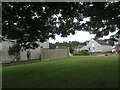
10
Path through Cairns Den, near St Andrews
Image: © Becky Williamson
Taken: 10 Jul 2021
0.14 miles