IMAGES TAKEN NEAR TO
Scooniehill Road, ST. ANDREWS, KY16 8HD
Introduction
This page details the photographs taken nearby to Scooniehill Road, KY16 8HD by members of the Geograph project.
The Geograph project started in 2005 with the aim of publishing, organising and preserving representative images for every square kilometre of Great Britain, Ireland and the Isle of Man.

There are currently over 7.5m images from over14,400 individuals and you can help contribute to the project by visiting https://www.geograph.org.uk
Image Map
Images are licensed for reuse under creativecommons.org/licenses/by-sa/2.0
Notes
- Clicking on the map will re-center to the selected point.
- The higher the marker number, the further away the image location is from the centre of the postcode.
Image Listing (17 Images Found)
Images are licensed for reuse under creativecommons.org/licenses/by-sa/2.0
Image
Details
Distance
1
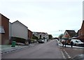
Frosty pavements
Scooniehill Road, after a keen frost.
Image: © James Allan
Taken: 21 Nov 2016
0.02 miles
2
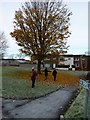
Fallen leaves
Alongside Pipelands Walk.
Image: © James Allan
Taken: 21 Nov 2016
0.03 miles
3
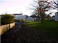
Wishart Gardens
Residential area of St Andrews.
Image: © Richard Webb
Taken: 26 Nov 2015
0.09 miles
4
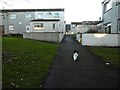
Towards James Rob Avenue
Cat wants to find out more about my camera.
Image: © Richard Webb
Taken: 26 Nov 2015
0.11 miles
5
Between Tom Morris Drive and Hamilton Avenue
Residential area, St Andrews.
Image: © Richard Webb
Taken: 26 Nov 2015
0.13 miles
6
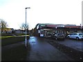
Shop off Tom Morris Drive
A path runs through this residential area to Pipeland.
Image: © Richard Webb
Taken: 26 Nov 2015
0.13 miles
7
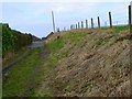
Pipelands track
A path leading south out of St Andrews towards the filter beds once used to purify the local water supply.
Image: © James Allan
Taken: 25 Jan 2010
0.14 miles
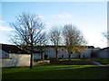
8

Premises owned by Scottish Water on walk from Scooniehill Road, St Andrews to Pipeland Steadings
The agricultural appearance of these sturdy stone buildings is misleading. Further along the same path to the left of Pipeland Steadings is a disused sewage facility, now serving as a refuge from the plough for local wildlife.
Image: © Trevor Smith
Taken: 3 Jan 2021
0.14 miles
9
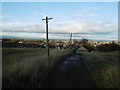
Road, Pipeland
The road served the waterworks which treated Cameron Reservoir water.
Image: © Richard Webb
Taken: 26 Nov 2015
0.15 miles
10
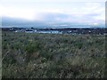
Unused field, Pipeland
On the edge of St Andrews, this field will almost certainly be built upon. View towards the new hospital.
Image: © Richard Webb
Taken: 26 Nov 2015
0.16 miles