IMAGES TAKEN NEAR TO
Ivy Lane, KIRKCALDY, KY1 2XD

Introduction

This page details the photographs taken nearby to Ivy Lane, KY1 2XD by members of the Geograph project.

The Geograph project started in 2005 with the aim of publishing, organising and preserving representative images for every square kilometre of Great Britain, Ireland and the Isle of Man.

There are currently over 7.5m images from over14,400 individuals and you can help contribute to the project by visiting https://www.geograph.org.uk

Image Map


Images are licensed for reuse under creativecommons.org/licenses/by-sa/2.0
Notes
  • Clicking on the map will re-center to the selected point.
  • The higher the marker number, the further away the image location is from the centre of the postcode.

Image Listing (92 Images Found)

Images are licensed for reuse under creativecommons.org/licenses/by-sa/2.0
  • ...
Image
Details
Distance
1
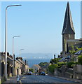
A955 in Dysart
On the left is the crooked spire of the Normand Road United Free Church.
Image: © Mat Fascione Taken: 22 Jul 2019
0.05 miles
2
Normand Road United Free Church
Image: © Ian Calderwood Taken: 28 Apr 2012
0.06 miles
3
Normand Road United Free Church in Dysart
The city of Edinburgh is 11 miles away across the Firth of Forth, with the Pentland Hills about 20 miles away.
Image: © Mat Fascione Taken: 22 Jul 2019
0.09 miles
4
Bakers' shop in Dysart
A traditional baker's offering some very good value for money according to the signs in the windows.
Image: © Lis Burke Taken: 12 Jun 2010
0.09 miles
5
Dysart Primary School
Image: © Ian Calderwood Taken: 28 Apr 2012
0.09 miles
6
Man in the Rock
Bar in Dysart on the junction of School Brae and the High Street.
Image: © Richard Webb Taken: 20 Sep 2009
0.10 miles
7
Quality Street
Not a sweet shop in sight!
Image: © Lis Burke Taken: 12 Jun 2010
0.10 miles
8
The Royal Hotel, Dysart
On Townhead.
Image: © JThomas Taken: 21 Jul 2021
0.10 miles
9
The Royal Hotel
The building is listed, category C(S), meaning that it is a "building of local importance".
Image: © Ian Calderwood Taken: 28 Apr 2012
0.10 miles
10
The Barony Church
The Barony was built in 1802. It closed as a church in 1972, when the congregation was merged with that of St Serf's, nearby. It became a YMCA for a while but is now disused and semi-derelict.
Image: © Ian Calderwood Taken: 28 Apr 2012
0.10 miles
  • ...