IMAGES TAKEN NEAR TO
Cairns Street East, KIRKCALDY, KY1 2DS
Introduction
This page details the photographs taken nearby to Cairns Street East, KY1 2DS by members of the Geograph project.
The Geograph project started in 2005 with the aim of publishing, organising and preserving representative images for every square kilometre of Great Britain, Ireland and the Isle of Man.

There are currently over 7.5m images from over14,400 individuals and you can help contribute to the project by visiting https://www.geograph.org.uk
Image Map
Images are licensed for reuse under creativecommons.org/licenses/by-sa/2.0
Notes
- Clicking on the map will re-center to the selected point.
- The higher the marker number, the further away the image location is from the centre of the postcode.
Image Listing (14 Images Found)
Images are licensed for reuse under creativecommons.org/licenses/by-sa/2.0
Image
Details
Distance
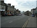
4
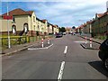
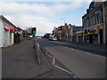
Sinclairtown district
The main street through the Sinclairtown area of Kirkcaldy is known, unsurprisingly, as St Clair Street and this view looks up it, away from the harbour area.
Image: © James Allan
Taken: 17 Feb 2009
0.10 miles
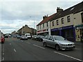
5
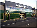
Rejects Department Store, St Clair Street
Image: © gordon povey
Taken: 24 Aug 2007
0.13 miles
6
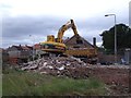
Demolition of the County Press Building
Having been disused for years, Fife Council decided that this building was dangerous and unsightly and that its demolition would improve the environment and community safety. The demolition was progressed under the Powers to advance well being legislation, the intention being to re-charge the costs to the owner of the building.
Image: © Ian Calderwood
Taken: 29 Aug 2011
0.13 miles
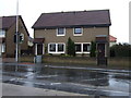
8
Open ground, Sinclairtown
Old maps show a continuous line of buildings along St Clair Street at this location; at some time they were demolished, leaving this patch of open ground.
Image: © Robert Struthers
Taken: 30 Dec 2014
0.15 miles
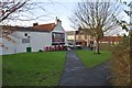
9
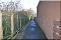
Sinclairtown Footpath
This short footpath runs between some waste ground and a car park.
Image: © Robert Struthers
Taken: 30 Dec 2014
0.16 miles
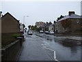
10
St Clair Street
Looking towards the Forth.
Image: © James Allan
Taken: 17 Feb 2009
0.19 miles