IMAGES TAKEN NEAR TO
Barnhill Road, DUNFERMLINE, KY11 9LL
Introduction
This page details the photographs taken nearby to Barnhill Road, KY11 9LL by members of the Geograph project.
The Geograph project started in 2005 with the aim of publishing, organising and preserving representative images for every square kilometre of Great Britain, Ireland and the Isle of Man.

There are currently over 7.5m images from over14,400 individuals and you can help contribute to the project by visiting https://www.geograph.org.uk
Image Map
Images are licensed for reuse under creativecommons.org/licenses/by-sa/2.0
Notes
- Clicking on the map will re-center to the selected point.
- The higher the marker number, the further away the image location is from the centre of the postcode.
Image Listing (67 Images Found)
Images are licensed for reuse under creativecommons.org/licenses/by-sa/2.0
Image
Details
Distance
2
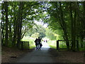
Crossroads and Signpost, Dalgety Bay
"The Avenue" Part of the Fife Coastal Path between Dalgety Bay and Aberdour. Near St. Bridget's Kirk. Crossroads and Directions. Clockwise from Signpost: North, South, East. Pedestrians and Cycles only.
Image: © Simon Johnston
Taken: 18 Aug 2005
0.08 miles
3
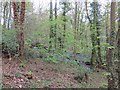
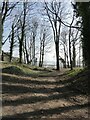
Fife Coastal Path in the Crow Hill Woods
Image: © Mat Fascione
Taken: 22 Jul 2019
0.09 miles
4
Crow Hill woods, Dalgety Bay
Woodland above the beach at Dalgety Bay.
Image: © Richard Webb
Taken: 1 May 2014
0.10 miles
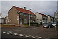
5
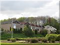
Dalgety Gardens
Houses above the Eastern Approach Road, Dalgety Bay.
Image: © Richard Webb
Taken: 1 May 2014
0.11 miles
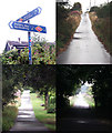
6
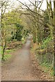
Coastal path at St Bridgets, Dalgety Bay
Coastal path at the ruined church, leading to the town.
Image: © edward mcmaihin
Taken: 25 Apr 2010
0.14 miles
7
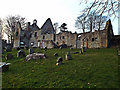
St Bridget's Kirk, Dalgety Bay
On the Fife Coastal Path, St Bridget's Kirk was built in the 1100's.
Image: © Charlotte Golledge
Taken: 5 Mar 2013
0.14 miles
8
Woodland above the shore of Dalgety Bay
Image: © Oliver Dixon
Taken: 22 Mar 2022
0.15 miles
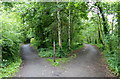
9
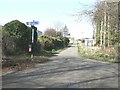
Junction on the private road from St Bridget's Kirk to Four Lums
The road to the right is Beech Avenue which carries the Fife Coastal Path through to Aberdour.
Image: © Oliver Dixon
Taken: 22 Mar 2022
0.15 miles