IMAGES TAKEN NEAR TO
Grange Road, DUNFERMLINE, KY11 3DZ
Introduction
This page details the photographs taken nearby to Grange Road, KY11 3DZ by members of the Geograph project.
The Geograph project started in 2005 with the aim of publishing, organising and preserving representative images for every square kilometre of Great Britain, Ireland and the Isle of Man.

There are currently over 7.5m images from over14,400 individuals and you can help contribute to the project by visiting https://www.geograph.org.uk
Image Map
Images are licensed for reuse under creativecommons.org/licenses/by-sa/2.0
Notes
- Clicking on the map will re-center to the selected point.
- The higher the marker number, the further away the image location is from the centre of the postcode.
Image Listing (11 Images Found)
Images are licensed for reuse under creativecommons.org/licenses/by-sa/2.0
Image
Details
Distance
1
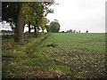
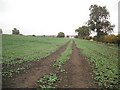
Oilseed rape, Wester Gellet
Road to Wester Gellet runs beside arable land. The Grange Road area will be very yellow in May 2010.
Image: © Richard Webb
Taken: 15 Oct 2009
0.13 miles
2
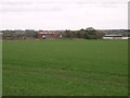
Easter Gellet Farm.
Looking eastwards to Easter Gellet.
Image: © Paul McIlroy
Taken: 5 Nov 2005
0.14 miles
3
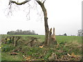
Broken Ash at Easter Gellet
Just off Grange Road
Image: © M J Richardson
Taken: 4 Apr 2014
0.15 miles
4
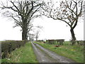
Track to Wester Gellet
This passes the farm, to come out on Limekilns Road Image
Image: © M J Richardson
Taken: 4 Apr 2014
0.16 miles
5
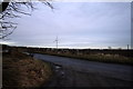
Grange Road Rosyth
The Grange Road at the junction with the road to Wester Gellet farm the wind turbine in the distance is located in Pitreavie Business Park.
Image: © edward mcmaihin
Taken: 20 Jan 2012
0.17 miles
6
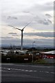
Wind Power
This wind turbine towers over Pitreavie Industrial Estate.
Image: © Robert Struthers
Taken: 28 Oct 2011
0.21 miles
7
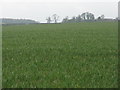
Winter cereal at Wester Gellet
Looking west from Grange Road to the farm on a very grey day.
Image: © M J Richardson
Taken: 4 Apr 2014
0.21 miles
8
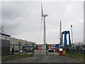
FMC Technologies' wind turbine
At Pitreavie Business Park, an oil and gas exploitation company.
Image: © M J Richardson
Taken: 25 Mar 2013
0.22 miles
9
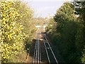
Railway Line.
This shot was taken from the bridge over the railway line at the northern side of the square. Looking northwards towards Dunfermline Abbey.
Image: © Paul McIlroy
Taken: 29 Oct 2005
0.23 miles
10
Oilseed rape, off Grange Road
Farmland between Grange Road and the railway. Beyond the railway is Pitreavie Industrial Estate.
Image: © Richard Webb
Taken: 15 Oct 2009
0.24 miles