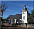
IMAGES TAKEN NEAR TO
Park Road, DUNFERMLINE, KY11 2SE

Introduction

This page details the photographs taken nearby to Park Road, KY11 2SE by members of the Geograph project.

The Geograph project started in 2005 with the aim of publishing, organising and preserving representative images for every square kilometre of Great Britain, Ireland and the Isle of Man.

There are currently over 7.5m images from over14,400 individuals and you can help contribute to the project by visiting https://www.geograph.org.uk

Image Map


Images are licensed for reuse under creativecommons.org/licenses/by-sa/2.0
Notes
  • Clicking on the map will re-center to the selected point.
  • The higher the marker number, the further away the image location is from the centre of the postcode.

Image Listing (18 Images Found)

Images are licensed for reuse under creativecommons.org/licenses/by-sa/2.0
Image
Details
Distance
1
Rosyth Library
It has been here in Parkgate since 1988.
Image: © Paul McIlroy Taken: 17 Apr 2007
0.05 miles
2
Former Rosyth Institute
One of the many buildings constructed by the Carnegie Dunfermline Trust to bring some "sweetness and light" to the lives of the local people.
Image: © Robert Struthers Taken: 29 Sep 2012
0.07 miles
3
Rosyth Parish Church
The original part of the building was constructed in 1930-31.
Image: © Robert Struthers Taken: 29 Sep 2012
0.17 miles
4
Rosyth parish church, Backmarch Road
Rosyth Church of Scotland parish church is B listed and designed in 1930 by Alfred Hugh Mottram. https://rosythparishchurch.org/about/ The Scottish National Housing Company was set up to provide houses for employees at Rosyth naval dockyard along Garden City lines. Dunfermline Town Council approved the Rosyth town planning scheme in July 1915 and the first houses were occupied in 1916. Raymond Unwin was expert advisor to the Admiralty in connection with the Rosyth scheme.
Image: © Kay Williams Taken: 18 Oct 2022
0.17 miles
5
Houses on Backmarch Road
A side street in Rosyth.
Image: © M J Richardson Taken: 4 Apr 2014
0.18 miles
6
Rosyth: Norval Place 'Garden City' housing
Terraced houses on Norval Place. The layout followed the new principles of town planning with broken frontage lines giving variety, areas of green space with trees lining the roads and private gardens front and back. The Scottish National Housing Company was set up to provide houses for employees at Rosyth naval dockyard along Garden City lines. Dunfermline Town Council approved the Rosyth town planning scheme in July 1915 and the first houses were occupied in 1916. Raymond Unwin was expert advisor to the Admiralty in connection with the Rosyth scheme. Alfred Hugh Mottram, as architect for the Scottish National Housing Company, worked on the layout and designed many of the houses. https://thepastandotherplaces.wordpress.com/2022/10/24/rosyth-garden-town/
Image: © Kay Williams Taken: 18 Oct 2022
0.20 miles
7
Shops, Queensferry Road
Row of shops on the corner with Park Road.
Image: © Richard Webb Taken: 15 Oct 2009
0.22 miles
8
Queensferry Road, Rosyth
A wide street, probably a main road in the past. Taken from outside shops near the junction with Admiralty Road.
Image: © Richard Webb Taken: 15 Oct 2009
0.22 miles
9
Palace, Rosyth
Former cinema. The Palace closed in 1971. Now a bar.
Image: © Richard Webb Taken: 15 Oct 2009
0.22 miles
10
Rosyth Public Park
Recreation ground with pond, putting green, pitches etc.
Image: © M J Richardson Taken: 20 Jun 2017
0.22 miles