IMAGES TAKEN NEAR TO
Simpson Court, ANSTRUTHER, KY10 3SZ

Introduction

This page details the photographs taken nearby to Simpson Court, KY10 3SZ by members of the Geograph project.

The Geograph project started in 2005 with the aim of publishing, organising and preserving representative images for every square kilometre of Great Britain, Ireland and the Isle of Man.

There are currently over 7.5m images from over14,400 individuals and you can help contribute to the project by visiting https://www.geograph.org.uk

Image Map


Images are licensed for reuse under creativecommons.org/licenses/by-sa/2.0
Notes
  • Clicking on the map will re-center to the selected point.
  • The higher the marker number, the further away the image location is from the centre of the postcode.

Image Listing (474 Images Found)

Images are licensed for reuse under creativecommons.org/licenses/by-sa/2.0
  • ...
Image
Details
Distance
1
South Crail
The edge of Crail around the Kirkmay edge of the town. Taken from the Sypsies farm road by the observation post.
Image: © Jim Bain Taken: 4 Nov 2007
0.05 miles
2
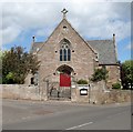
Crail's Catholic Church
Built in 1859 as an United Presbyterian Church, at that time a division of the Free Church, it was bought and converted into a Catholic Church in 1942. In part this was possible by donations from the large number of Polish armed forces based around the area.
Image: © Jim Bain Taken: 22 Sep 2007
0.09 miles
3
Holy Trinity Catholic Church
The Holy Trinity Catholic Church at the junction of Lamont Terrace and the A917 Anstruther Road in Crail.
Image: © Scott Cormie Taken: 6 Oct 2020
0.09 miles
4
North Crail
The area round the bowls club from the Sypsies farm road
Image: © Jim Bain Taken: 4 Nov 2007
0.10 miles
5
Crail, East Neuk Hotel
Image: © Astrid H Taken: 10 Jul 2009
0.10 miles
6
Crail Parish Church, Fife
Crail Parish Church, located opposite the Marketgate in the centre of the East Neuk burgh.
Image: © Jerzy Morkis Taken: Unknown
0.10 miles
7
Most Holy Trinity Church, Crail
On the junction between Westgate and Lamont Terrace.
Image: © Richard Webb Taken: 3 Jul 2010
0.10 miles
8
Holy Trinity Catholic Church
At the corner of Westgate and Lamont Terrace, Crail.
Image: © Richard Sutcliffe Taken: 24 May 2019
0.10 miles
9
9 and 7 Westgate, Crail
Both Category B listed, 18th century buildings.
Image: © Richard Sutcliffe Taken: 24 May 2019
0.11 miles
10
East Neuk Hotel
Popular hostelry on Crail's main thoroughfare. Frequently photographed by Dutch-speaking visitors because the work 'neuk' to them has a similar significance to the word 'f**k' in English.
Image: © James Allan Taken: 2 Apr 2008
0.11 miles
  • ...