1
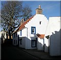
The Studio
Eighteenth century, Category B listed [http://portal.historicenvironment.scot/designation/LB36203] house on Esplanade. Once an inn.
Image: © Richard Sutcliffe
Taken: 18 Mar 2019
0.00 miles
2
The Studio
18th century, once a harbour office on the ground floor and inn above, now a private residence. It is Category B listed https://portal.historicenvironment.scot/designation/LB36203.
Image: © Richard Sutcliffe
Taken: 16 Jun 2023
0.00 miles
3
Looking up Shore from The Esplanade, Anstruther
The narrow street is "Shore"; The Esplanade is really mainly a car park.
Image: © Gordon Brown
Taken: 3 Nov 2017
0.00 miles
4
4 Shore, Anstruther Wester
Category B listed house, dating from 1718. Looking towards High Street.
Image: © Richard Sutcliffe
Taken: 18 Mar 2019
0.00 miles
5
Anstruther - houses near the Dreel Halls
Image: © Ian Hawfinch
Taken: 20 Feb 2020
0.01 miles
6
'The Studio' at 2 Esplanade, Anstruther Wester
A mid 18th century cottage, presumably built by or for a fisherman, and now a rather desirable home; it was Category B listed https://britishlistedbuildings.co.uk/200380931-the-studio-shore-east-neuk-and-landward-ward#.W494QOhKhPY in 1972.
Image: © Richard Law
Taken: 18 May 2018
0.01 miles
7
Esplanade, Anstruther
The Esplanade is on the left, the end of which is a small car park. Dreel Halls (the former Anstruther Wester Parish Church) is in the centre; and Castle Street on the right. The Dreel Burn enters the sea at this point.
Image: © Richard Sutcliffe
Taken: 17 Mar 2019
0.01 miles
8
Dreel Halls and surrounding buildings - Anstruther
Image: © Ian Hawfinch
Taken: 20 Feb 2020
0.01 miles
9
Wester Anstruther
Houses by the Dreel Bridge with Anstruther Wester Church spire dominating the skyline.
Image: © Jim Bain
Taken: 14 Apr 2007
0.01 miles
10
Slipway into old harbour, Anstruther
A cobbled slipway leads down from Esplanade into Anstruther's original harbour (see Canmore https://canmore.org.uk/site/34183/anstruther-wester-harbour). Behind is the Category B listed Studio (and associated garage). Behind them are the Category A listed Merchants House and No.3 Shore.
Image: © Richard Sutcliffe
Taken: 23 May 2019
0.01 miles


