IMAGES TAKEN NEAR TO
Cunzie Street, ANSTRUTHER, KY10 3DF

Introduction

This page details the photographs taken nearby to Cunzie Street, KY10 3DF by members of the Geograph project.

The Geograph project started in 2005 with the aim of publishing, organising and preserving representative images for every square kilometre of Great Britain, Ireland and the Isle of Man.

There are currently over 7.5m images from over14,400 individuals and you can help contribute to the project by visiting https://www.geograph.org.uk

Image Map


Images are licensed for reuse under creativecommons.org/licenses/by-sa/2.0
Notes
  • Clicking on the map will re-center to the selected point.
  • The higher the marker number, the further away the image location is from the centre of the postcode.

Image Listing (650 Images Found)

Images are licensed for reuse under creativecommons.org/licenses/by-sa/2.0
  • ...
Image
Details
Distance
1
Anstruther Town Hall
Seen here is the gable elevation at the far end of the same building as Image, which is Anstruther's Town Hall; it was Category B listed https://britishlistedbuildings.co.uk/200380821-anstruther-town-hall-east-neuk-and-landward-ward#.W_mxRNSLTGg in 1972, and built in Baronial style in the early 1870s by a St Andrews architect.
Image: © Richard Law Taken: 4 Oct 2018
0.01 miles
2
Anstruther Parish Church
From by the hall
Image: © Jim Bain Taken: 23 Sep 2007
0.02 miles
3
East High Street, Anstruther
The far eastern end of the High Street from by Rodger Street and Pringles
Image: © Jim Bain Taken: 21 Sep 2008
0.02 miles
4
Ingenious cycle racks
Outside a premises in Cunzie Street, Anstruther.
Image: © Oliver Dixon Taken: 17 Oct 2019
0.02 miles
5
Princess Titaua's memorial
Memorial to Princess Titaua Marama of Tahita. Wife to George Darsie. Born Papetdai Moorea, November 3rd 1842 Died, Anstruther September 25th 1898 aged 55. A long way from her native home.
Image: © Jim Bain Taken: 23 Sep 2007
0.02 miles
6
57-61 High Street East, Anstruther Easter
The address of this building also includes 11 Cunzie Street, which forms the leftmost part of it as seen here. The part that faces us is 57-61 High Street East, and dates from the late 19th century. It has previously been used as a Masonic Lodge or Temple, and was Category C listed https://britishlistedbuildings.co.uk/200380804-masonic-lodge-57-61-high-street-east-anstruther-easter-kilrenny#.YpOvv6jMLIU in 1972. Sadly, a certain amount of dereliction has set in in recent years.
Image: © Richard Law Taken: 6 May 2022
0.02 miles
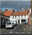
7
Cunzie Street, Anstruther Easter
Image: © Richard Sutcliffe Taken: 17 Mar 2019
0.03 miles
8
The Lighthouse
Murray's Chippy and the Lighthouse.
Image: © Jim Bain Taken: 6 May 2007
0.03 miles
9
The Wee Neuk tearoom on Cunzie Street
A small tearoom/takeaway trading from the ground floor premises of a 19th century cottage just behind the main Shore Street.
Image: © Richard Law Taken: 4 Oct 2018
0.03 miles
10
St Ayle, Church of Scotland, Anstruther Easter
Category A listed church [http://portal.historicenvironment.scot/designation/LB36066], dating from 1634. Also known as St Adrian's church.
Image: © Richard Sutcliffe Taken: 17 Mar 2019
0.03 miles
  • ...