IMAGES TAKEN NEAR TO
John Street, ANSTRUTHER, KY10 3BB

Introduction

This page details the photographs taken nearby to John Street, KY10 3BB by members of the Geograph project.

The Geograph project started in 2005 with the aim of publishing, organising and preserving representative images for every square kilometre of Great Britain, Ireland and the Isle of Man.

There are currently over 7.5m images from over14,400 individuals and you can help contribute to the project by visiting https://www.geograph.org.uk

Image Map


Images are licensed for reuse under creativecommons.org/licenses/by-sa/2.0
Notes
  • Clicking on the map will re-center to the selected point.
  • The higher the marker number, the further away the image location is from the centre of the postcode.

Image Listing (242 Images Found)

Images are licensed for reuse under creativecommons.org/licenses/by-sa/2.0
  • ...
Image
Details
Distance
1
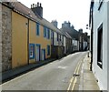
John Street, Cellardyke
The Fife Coastal Path winds through the narrow streets of Cellardyke to avoid the rocky shoreline between Anstruther Easter and Cellardyke Harbour.
Image: © Greg Fitchett Taken: 20 Mar 2017
0.01 miles
2
John Street, Cellardyke
The south side of John Street (looking east), Cellardyke, in the East Neuk of Fife.
Image: © Jerzy Morkis Taken: 29 Aug 2020
0.01 miles
3
John Street, Cellardyke
No parking is allowed in the narrow street.
Image: © Richard Sutcliffe Taken: 12 Jun 2023
0.01 miles
4
Houses in John Street
Houses with forestairs were typical of Scotland's vernacular architecture in the past, especially, though not exclusively, in fishing villages. These are the same houses shown in Image
Image: © kim traynor Taken: 7 Jun 2013
0.01 miles
5
Houses in John Street
Houses with forestairs were typical of Scotland's vernacular architecture in the past, especially, though not exclusively, in fishing villages. These are the same houses shown in Image
Image: © kim traynor Taken: 7 Jun 2013
0.01 miles
6
Cottage on John Street
18th century cottage on John Street, with forestair and stand-out paintwork. It is Category B listed https://portal.historicenvironment.scot/designation/LB36017.
Image: © Richard Sutcliffe Taken: 12 Jun 2023
0.01 miles
7
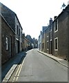
John Street, Cellardyke
Motor traffic was not envisaged when these narrow streets were first laid out!
Image: © Oliver Dixon Taken: 5 Apr 2019
0.02 miles
8
John Street, Cellardyke, Fife
A westward view of the south side of John Street, Cellardyke, in the East Neuk of Fife.
Image: © Jerzy Morkis Taken: 29 Aug 2020
0.02 miles
9
John Street, Cellardyke
Image: © Richard Sutcliffe Taken: 12 Jun 2023
0.02 miles
10
John Street, Cellardyke, Fife
The north side of John Street (looking west), Cellardyke, in the East Neuk of Fife.
Image: © Jerzy Morkis Taken: 29 Aug 2020
0.02 miles
  • ...