IMAGES TAKEN NEAR TO
The Gyles, ANSTRUTHER, KY10 2NG

Introduction

This page details the photographs taken nearby to The Gyles, KY10 2NG by members of the Geograph project.

The Geograph project started in 2005 with the aim of publishing, organising and preserving representative images for every square kilometre of Great Britain, Ireland and the Isle of Man.

There are currently over 7.5m images from over14,400 individuals and you can help contribute to the project by visiting https://www.geograph.org.uk

Image Map


Images are licensed for reuse under creativecommons.org/licenses/by-sa/2.0
Notes
  • Clicking on the map will re-center to the selected point.
  • The higher the marker number, the further away the image location is from the centre of the postcode.

Image Listing (422 Images Found)

Images are licensed for reuse under creativecommons.org/licenses/by-sa/2.0
  • ...
Image
Details
Distance
1
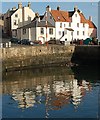
Old Harbour buildings, Pittenweem, Fife
Image: © Alex Passmore Taken: 31 May 2019
0.01 miles
2
Pittenweem roofs
Until refrigeration was invented, herring were gutted and put in barrels with salt to preserve them. Sailing ships came from Holland (Netherlands) to buy the fish. As they were sailing to Scotland without a cargo they needed to load ballast for weight to keep the ships balanced. Often sailors used rocks, which they could throw overboard before they loaded their cargo. However the Dutch sailors loaded red roof tiles as ballast and sold them when they arrived in port. That is why houses in the "East Neuk" of Fife have red pantile roofs.
Image: © John McMillan Taken: 2 May 2006
0.01 miles
3
Eastshore Street
Eastshore street and the fine buildings at its junction with Abbey Wall road.
Image: © Jim Bain Taken: 3 Nov 2007
0.01 miles
4
East Shore and Abbey Wall Road, Pittenweem
Pittenweem is currently the most active of the several fishing harbours on the East Neuk coast of Fife.
Image: © Graham Hogg Taken: 14 May 2014
0.01 miles
5
House at the end of the Pittenweem breakwater
Image: © John Allan Taken: 8 Apr 2010
0.01 miles
6
Pittenweem
This would appear to be where a creek has been channelled to enter the Harbour between some houses.
Image: © Ron Hann Taken: Unknown
0.01 miles
7
Lobster Pots and Midshore, Pittenweem
Image: © Les Hull Taken: 11 Mar 2013
0.01 miles
8
Sea wall at Pittenweem
A section of sea wall situated to the east of Pittenweem harbour.
Image: © William Starkey Taken: 1 Jul 2014
0.01 miles
9
Harbour Houses, Pittenweem
Image: © Anthony O'Neil Taken: Unknown
0.01 miles
10
Creels, Gyles
Creels stacked beside Pittemweem Harbour
Image: © Frances Webb Taken: 21 Feb 2010
0.01 miles
  • ...