1
Gatehouse, Pittenweem Priory
Probably dating from the 15th century, it is a Category A listed building.
Image: © Richard Sutcliffe
Taken: 21 Mar 2019
0.02 miles
2
Entrance to St Fillan's cave, Pittenweem
Image: © Gordon Brown
Taken: 13 Mar 2008
0.03 miles
3
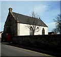
St John's Episcopal Church, Pittenweem
Category B listed church on Marygate, originally dating from 1805, but altered in 1869 and 1924.
Image: © Richard Sutcliffe
Taken: 21 Mar 2019
0.03 miles
4
St John's Episcopal Church, Pittenweem
A Category B listed church http://portal.historicenvironment.scot/designation/LB39882, built in 1805, with some later alterations. The gravestones are in the Pittenweem Parish Church's graveyard.
Image: © Richard Sutcliffe
Taken: 25 Oct 2020
0.03 miles
5
War grave, Pittenweem
The gravestone was erected by Alexander & Jean Hughes in loving memory of their son:
ANDREW HUGHES
SEAMAN GUNNER
DIED ON H.M.T.REFUNDO
18TH DEC. 1940, AGED 24 YEARS.
The lettering on the stone relating to Andrew Hughes has been restored by the Commonwealth War Graves Commission.
HMT Refundo was launched in 1916, and requisitioned by the Royal Navy in 1940. She was sunk east of Landguard Point (Harwich) while under tow after being mined on 18th December 1940.
Image: © Richard Sutcliffe
Taken: 25 Oct 2020
0.04 miles
6
St John's Episcopal Church, Pittenweem
Category B listed church on Marygate, originally dating from 1805, but altered in 1869 and 1924.
Image: © Richard Sutcliffe
Taken: 21 Mar 2019
0.04 miles
7
The Great House
Part of the former Pittenweem Priory [https://canmore.org.uk/site/34240/pittenweem-marygate-pittenweem-priory].
Image: © Richard Sutcliffe
Taken: 21 Mar 2019
0.04 miles
8
Old priory wall and gravestones
The wall was part of Pittenweem Priory, probably dating from the 15th century. The gravestones are in the churchyard of Pittenweem Parish Church. There are several Commonwealth War Graves in the churchyard, including the one on the right
Image
Image: © Richard Sutcliffe
Taken: 25 Oct 2020
0.04 miles
9
Cove Wynd in Pittenweem
Image: © Mat Fascione
Taken: 24 Jul 2019
0.04 miles
10
Commonwealth War Grave: J. H. Brand
One of several Commonwealth War Graves in the churchyard at Pittenweem.
J. H. BRAND
LEADING SEAMAN RNR 5859/A
H.M. TRAWLER "MERLIN II"
26th NOVEMBER 1918 AGE 25
Merlin II was one of hundreds of fishing vessels taken into naval service in World War 1. She entered service in October 1914 as a minesweeper and was based in Portland on the south coast of England.
Image: © Richard Sutcliffe
Taken: 25 Oct 2020
0.05 miles


