IMAGES TAKEN NEAR TO
St. Monans, ANSTRUTHER, KY10 2DB
Introduction
This page details the photographs taken nearby to KY10 2DB by members of the Geograph project.
The Geograph project started in 2005 with the aim of publishing, organising and preserving representative images for every square kilometre of Great Britain, Ireland and the Isle of Man.

There are currently over 7.5m images from over14,400 individuals and you can help contribute to the project by visiting https://www.geograph.org.uk
Image Map
Images are licensed for reuse under creativecommons.org/licenses/by-sa/2.0
Notes
- Clicking on the map will re-center to the selected point.
- The higher the marker number, the further away the image location is from the centre of the postcode.
Image Listing (54 Images Found)
Images are licensed for reuse under creativecommons.org/licenses/by-sa/2.0
Image
Details
Distance
3
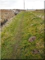
Footpath approaching the A917
The path follows the Inverie Burn.
Image: © Richard Sutcliffe
Taken: 20 Mar 2019
0.09 miles
4
Showjumping paddock
Close to Newark House this showjumping practice paddock lies adjacent to the Fife Coastal Path high tide alternative route.
Image: © Bill Kasman
Taken: 18 Jun 2022
0.12 miles
5
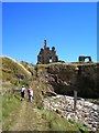
Approaching Newark Castle from the West
Image: © Paul Thomson
Taken: 3 Aug 2006
0.14 miles
6
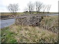
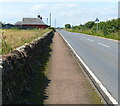
Bridge on the A917
The road crosses the Inverie Burn.
Image: © Richard Sutcliffe
Taken: 20 Mar 2019
0.14 miles
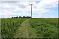
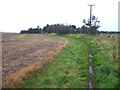
7
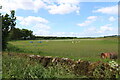
Scots Pine
A single bent Scots Pine tree at a corner of the field just north of Newark Farmhouse.
Image: © Richard Sutcliffe
Taken: 20 May 2019
0.15 miles
8
Fife Coastal Path
This is the high tide alternative route as it heads towards Newark House and farm cottages.
Image: © Bill Kasman
Taken: 18 Jun 2022
0.16 miles
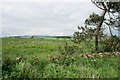
9
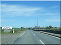
High tide route at Newark Farm
This is the route that walkers on the Fife Coastal Path should take when the tide covers the alternative route along the shore.
Image: © Oliver Dixon
Taken: 18 Oct 2019
0.16 miles
10
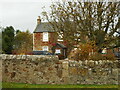
Newark Farmhouse
A Category C listed farmhouse http://portal.historicenvironment.scot/designation/LB15555, close to Newark Castle.
Image: © Richard Sutcliffe
Taken: 27 Oct 2020
0.16 miles