
IMAGES TAKEN NEAR TO
Evie, ORKNEY, KW17 2NN
Introduction
This page details the photographs taken nearby to KW17 2NN by members of the Geograph project.
The Geograph project started in 2005 with the aim of publishing, organising and preserving representative images for every square kilometre of Great Britain, Ireland and the Isle of Man.

There are currently over 7.5m images from over14,400 individuals and you can help contribute to the project by visiting https://www.geograph.org.uk
Image Map
Images are licensed for reuse under creativecommons.org/licenses/by-sa/2.0
Notes
- Clicking on the map will re-center to the selected point.
- The higher the marker number, the further away the image location is from the centre of the postcode.
Image Listing (10 Images Found)
Images are licensed for reuse under creativecommons.org/licenses/by-sa/2.0
Image
Details
Distance
1
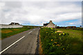
Passing through Costa
Heading north west around the coast of Orkney.
Image: © Andy Farrington
Taken: 15 May 2013
0.05 miles
4
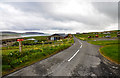
Muckle Pow
View south east along the A966 with the Eynhallow Sound to the left.
Image: © Andy Farrington
Taken: 15 May 2013
0.10 miles

6
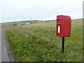
Costa: postbox № KW17 58
This postbox, serving the scattered community of Costa, is emptied at noon daily, except Sundays.
Image: © Chris Downer
Taken: 26 Jul 2011
0.15 miles
7
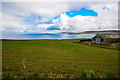
Fields in Costa
Looking north towards Eynhallow and Rousay on the horizon.
Image: © Andy Farrington
Taken: 15 May 2013
0.16 miles
8
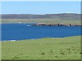
Green pastures, blue seas
View from the roadside at Costa looking towards the coastline with the small island of Eynhallow in the middle distance and Rousay beyond.
Image: © Gordon Hatton
Taken: 18 Jun 2021
0.19 miles
9
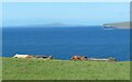
Towards the coast at Costa
Two almost roofless ruins towards the shore with the cliffs of Rousay to the right and Westray further out to the left.
Image: © Gordon Hatton
Taken: 18 Jun 2021
0.19 miles
10
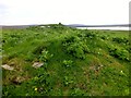
Vinquin Hill
Walked up track to house then into field near ruined cottages with Jim Bloomer and Tricky Speirs.
Name: Vinquin Hill
Hill number:12215
Height: 100m / 328ft
Parent (Ma/M):1555 Milldoe - Mid Tooin
Area:23: Orkney Islands
Class:1
Grid ref: HY327282 (est)
Drop: 37m
Col: 63m HY332270
Image: © Rude Health
Taken: 31 May 2014
0.23 miles