IMAGES TAKEN NEAR TO
Forss, THURSO, KW14 7XU
Introduction
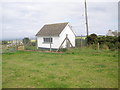
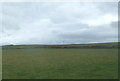
This page details the photographs taken nearby to KW14 7XU by members of the Geograph project.
The Geograph project started in 2005 with the aim of publishing, organising and preserving representative images for every square kilometre of Great Britain, Ireland and the Isle of Man.

There are currently over 7.5m images from over14,400 individuals and you can help contribute to the project by visiting https://www.geograph.org.uk
Image Map
Images are licensed for reuse under creativecommons.org/licenses/by-sa/2.0
Notes
- Clicking on the map will re-center to the selected point.
- The higher the marker number, the further away the image location is from the centre of the postcode.
Image Listing (8 Images Found)
Images are licensed for reuse under creativecommons.org/licenses/by-sa/2.0
Image
Details
Distance
2

Burn of Brimms coming down from Hill of Forss
Image: © John Ferguson
Taken: 12 Aug 2010
0.11 miles
4
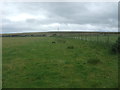
Farm track near Forss Holdings
Short walk from the A836.
Image: © JThomas
Taken: 13 Aug 2016
0.18 miles