
IMAGES TAKEN NEAR TO
Dunbar Terrace, THURSO, KW14 7NF
Introduction
This page details the photographs taken nearby to Dunbar Terrace, KW14 7NF by members of the Geograph project.
The Geograph project started in 2005 with the aim of publishing, organising and preserving representative images for every square kilometre of Great Britain, Ireland and the Isle of Man.

There are currently over 7.5m images from over14,400 individuals and you can help contribute to the project by visiting https://www.geograph.org.uk
Image Map
Images are licensed for reuse under creativecommons.org/licenses/by-sa/2.0
Notes
- Clicking on the map will re-center to the selected point.
- The higher the marker number, the further away the image location is from the centre of the postcode.
Image Listing (5 Images Found)
Images are licensed for reuse under creativecommons.org/licenses/by-sa/2.0
Image
Details
Distance
1
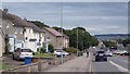
Ormlie Road, Thurso
Descent into town with Dunnet Head in the background.
Image: © Richard Webb
Taken: 7 Aug 2015
0.18 miles
2
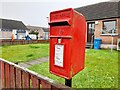
Post Box, Provost Sinclair Road, Thurso
KW14 6D. Royal Mail list this box as Provost Sinclair Road.
Image: © David Bremner
Taken: 30 Jul 2021
0.20 miles
3
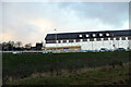
The new Premier Inn at Thurso
Built on the site of the old auction mart and just a 5-minute walk from the station.
Image: © John Lucas
Taken: 8 Dec 2021
0.23 miles
4
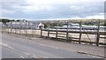
Site awaiting development, Thurso Station
Older aerial photographs show an industrial complex here with a large building. Probably to do with Dounreay.
Image: © Richard Webb
Taken: 7 Aug 2015
0.24 miles
5
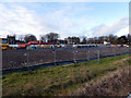
Construction at Thurso
Viewed from the station. This is a new Premier Inn being built in the site where the old cattle mart once stood but which closed circa 2006. Image
Image: © John Lucas
Taken: 5 Nov 2019
0.24 miles