
IMAGES TAKEN NEAR TO
Park Street, GOLSPIE, KW10 6RY
Introduction
This page details the photographs taken nearby to Park Street, KW10 6RY by members of the Geograph project.
The Geograph project started in 2005 with the aim of publishing, organising and preserving representative images for every square kilometre of Great Britain, Ireland and the Isle of Man.

There are currently over 7.5m images from over14,400 individuals and you can help contribute to the project by visiting https://www.geograph.org.uk
Image Map
Images are licensed for reuse under creativecommons.org/licenses/by-sa/2.0
Notes
- Clicking on the map will re-center to the selected point.
- The higher the marker number, the further away the image location is from the centre of the postcode.
Image Listing (106 Images Found)
Images are licensed for reuse under creativecommons.org/licenses/by-sa/2.0
Image
Details
Distance
1

The Sutherland Arms Hotel
Handy for the School Hostel as it was only 60 yards away!.
Image: © Donald H Bain
Taken: 6 Oct 2005
0.09 miles
2

Railway overbridge Golspie
This Far North railway overbridge on Argo Terrace has a height clearance of only 9 feet. The thin nature of the bridge deck illustrates the lightweight construction of the railway line
Image: © valenta
Taken: 4 Aug 2019
0.09 miles
4

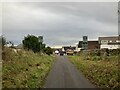
A Church in Golspie
I don't know the name of it but I thought it looked nice
Image: © Donald H Bain
Taken: 7 Sep 2005
0.11 miles
5

Sutherland Arms Hotel
Sutherland Arms Hotel in Golspie - possibly closer to the road than it looks in this photo!
Image: © Graeme Smith
Taken: 5 Jul 2008
0.13 miles
6
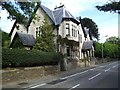
The Old School Hostel
It used to be called the MacLeod House, it was the school hostel for years, for the kids that could not travel from places like Lochinver.
Image: © Donald H Bain
Taken: 6 Oct 2005
0.14 miles

8
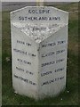
Not (that) far to go
If you are heading towards John O' Groats - of course if you are heading towards Land's End it still is quite a way according to the milepost at the Sutherland Arms in Golspie
Image: © Graeme Smith
Taken: 5 Jul 2008
0.14 miles
9
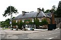
Sutherland Arms
A roadside hotel on the north side of Golspie.
Image: © Andrew Wood
Taken: 20 Jul 2009
0.15 miles
10
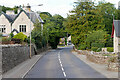
The A9 through Golspie
Golspie is a village and parish in Sutherland, in the Scottish Highland Region. The village lies on the A9 along the North Sea coast in the shadow of Ben Bhraggie. It had a population of around 1,350 at the 2011 census. The name is derived from the Norse for "gully village".
Image: © David Dixon
Taken: 25 Sep 2021
0.15 miles