IMAGES TAKEN NEAR TO
Park Road, EAST MOLESEY, KT8 9LD
Introduction
This page details the photographs taken nearby to Park Road, KT8 9LD by members of the Geograph project.
The Geograph project started in 2005 with the aim of publishing, organising and preserving representative images for every square kilometre of Great Britain, Ireland and the Isle of Man.

There are currently over 7.5m images from over14,400 individuals and you can help contribute to the project by visiting https://www.geograph.org.uk
Image Map
Images are licensed for reuse under creativecommons.org/licenses/by-sa/2.0
Notes
- Clicking on the map will re-center to the selected point.
- The higher the marker number, the further away the image location is from the centre of the postcode.
Image Listing (34 Images Found)
Images are licensed for reuse under creativecommons.org/licenses/by-sa/2.0
Image
Details
Distance
5
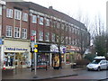
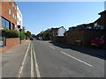
East Molesey
Shopping parade in Walton Road with flats above the street level.
Image: © Colin Smith
Taken: 16 Dec 2010
0.13 miles
7
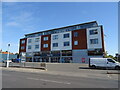
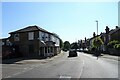
Flats above businesses on Walton Road, Molesey
Image: © JThomas
Taken: 29 Jul 2022
0.13 miles
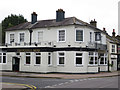
8
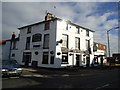
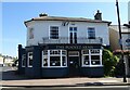
Poyntz Arms, East Moseley
A Shepherd Neame pub on Walton Road.
Image: © Oast House Archive
Taken: 20 Aug 2015
0.13 miles
9
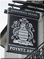
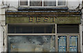
Poyntz Arms sign
Sign for Image], a Shepherd Neame pub on Walton Road.
Image: © Oast House Archive
Taken: 20 Aug 2015
0.13 miles
10
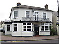
Poyntz Arms, East Moseley
A Shepherd Neame pub on Walton Road.
Image: © Oast House Archive
Taken: 20 Aug 2015
0.13 miles