IMAGES TAKEN NEAR TO
Molesey Road, WEST MOLESEY, KT8 2HF
Introduction
This page details the photographs taken nearby to Molesey Road, KT8 2HF by members of the Geograph project.
The Geograph project started in 2005 with the aim of publishing, organising and preserving representative images for every square kilometre of Great Britain, Ireland and the Isle of Man.

There are currently over 7.5m images from over14,400 individuals and you can help contribute to the project by visiting https://www.geograph.org.uk
Image Map
Images are licensed for reuse under creativecommons.org/licenses/by-sa/2.0
Notes
- Clicking on the map will re-center to the selected point.
- The higher the marker number, the further away the image location is from the centre of the postcode.
Image Listing (35 Images Found)
Images are licensed for reuse under creativecommons.org/licenses/by-sa/2.0
Image
Details
Distance
4
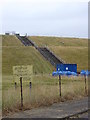
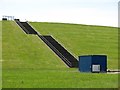
Queen Elizabeth II Storage Reservoir
This area contains many reservoirs for London's drinking water.
The sign warns it may contain toxic blue/green algae.
Image: © steve
Taken: 26 Jun 2005
0.08 miles
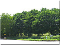
5
Embankment of the Queen Elizabeth II Storage Reservoir
At its northeast corner, between Molesey Road and Walton Road.
Image: © Mike Quinn
Taken: 6 Jun 2018
0.09 miles
6
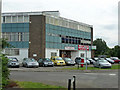
Multi-purpose building, West Molesey
Snooker centre, car sales, stone worktops and offices to let.
Image: © Robin Webster
Taken: 1 Sep 2012
0.10 miles
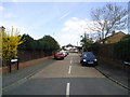
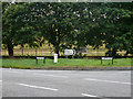
7
Molesey Road / Walton Road (3)
Shows the location of Image
Image: © Mike Quinn
Taken: 6 Jun 2018
0.11 miles
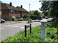
8
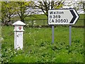
Corporation of London coal-tax post, at the junction of Molesey Road and the B369
The Coal Duties Act of 1851 gave the Corporation of the City of London the power to tax coal and other goods entering the Metropolitan area. The boundary of the area - for this purpose - was marked by posts or other markers.
This is not the only coal-tax post to survive in this area. Its nearest neighbour (to my knowledge) stands about 400m further south along Molesey Road, near the corner of Pool Road. The landscape here must have changed greatly since 1851, with farming and horticulture giving way to reservoirs and suburban development. That being so, it may well be that the surviving coal-posts have been moved from their original sites.
Image: © Stefan Czapski
Taken: 5 Apr 2014
0.11 miles
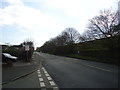
9
London coal tax post, West Molesey
At the corner of Walton and Molesey Roads.
Image: © Robin Webster
Taken: 1 Sep 2012
0.11 miles
10

Coal tax boundary post no.99, Molesey Road / Walton Road (detail)
See Image
Image: © Mike Quinn
Taken: 6 Jun 2018
0.11 miles