IMAGES TAKEN NEAR TO
Apps Meadow Close, WEST MOLESEY, KT8 2AE
Introduction
This page details the photographs taken nearby to Apps Meadow Close, KT8 2AE by members of the Geograph project.
The Geograph project started in 2005 with the aim of publishing, organising and preserving representative images for every square kilometre of Great Britain, Ireland and the Isle of Man.

There are currently over 7.5m images from over14,400 individuals and you can help contribute to the project by visiting https://www.geograph.org.uk
Image Map
Images are licensed for reuse under creativecommons.org/licenses/by-sa/2.0
Notes
- Clicking on the map will re-center to the selected point.
- The higher the marker number, the further away the image location is from the centre of the postcode.
Image Listing (37 Images Found)
Images are licensed for reuse under creativecommons.org/licenses/by-sa/2.0
Image
Details
Distance
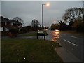
3
New houses
Being built by Bessborough Reservoir, one of the storage reservoirs associated with Walton water treatment works.
Image: © Hugh Venables
Taken: 6 Nov 2010
0.03 miles
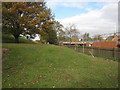
9
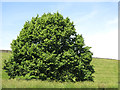
Chestnut tree by the embankment of Bessborough Reservoir
Image: © Mike Quinn
Taken: 6 Jun 2018
0.08 miles